


|
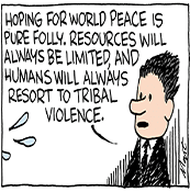
Edgar Allen Ho posted:India is a monoculture. What divides could you find there as contentious as the great New Mexico-Arizona feud? Well, they are now that Modi has united the people!
|
 #
?
Jul 21, 2019 13:12
#
?
Jul 21, 2019 13:12
|
|

|

|
| # ? Jun 7, 2024 20:53 |
|
|
Delthalaz posted:LOL at the independent pacific coast. What possible justification could there be for that? The deepest cultural divide in the US is through the rockies? this might be the worst map of this type I’ve seen. Greater Cascadia
|
|
#
?
Jul 21, 2019 16:15
|
|


|
There was definitely a gimmick poster somewhere in D&D at one point whose whole thing was arguing that east-west was a bigger cultural divide in the US than north-south and all policy must flow from this
|
|
#
?
Jul 21, 2019 16:39
|
|

|
 members of the Unrepresented Nations and Peoples Organization Molentik fucked around with this message at 00:48 on Jul 22, 2019 |
|
#
?
Jul 22, 2019 00:19
|
|


|
If you insist on making us guess, please put a description of the map in spoiler tags, at least.
|
|
#
?
Jul 22, 2019 00:40
|
|

|
I really enjoy that DC is on that.
|
|
#
?
Jul 22, 2019 00:40
|
|


|
Count Roland posted:If you insist on making us guess, please put a description of the map in spoiler tags, at least. Fixed ")
|
|
#
?
Jul 22, 2019 00:48
|
|
|
The only thing I recognize is somehow England has a thin blue line flag.Spaced God posted:this is.... impressively bad. Croatia is dalm. "Saudi Terrorists" is an odd choice for your ideal world. No idea who Kalmar is, but apparently he decided to let Canada have Greenland. The new city-states of Brussels, Baghdad, and I guess...Aragon? I feel like people who are in favor of one big west coast nation are weird in the head.
|
|
#
?
Jul 22, 2019 00:59
|
|


|
SlothfulCobra posted:No idea who Kalmar is, but apparently he decided to let Canada have Greenland. The Kalmar Union was a not very successful unification of the Scandanavian crowns that lasted for about 100 years 500 years ago.
|
|
#
?
Jul 22, 2019 01:09
|
|

|
SlothfulCobra posted:The only thing I recognize is somehow England has a thin blue line flag. it says saudi territories
|
|
#
?
Jul 22, 2019 01:18
|
|

|

|
|
#
?
Jul 22, 2019 01:34
|
|
|
Golbez posted:Heh, this has a lot of stuff in it. Every single part of every border here is strange. this post and this dispute make me very happy
|
|
#
?
Jul 22, 2019 01:36
|
|

|
Epicurius posted:The Kalmar Union was a not very successful unification of the Scandanavian crowns that lasted for about 100 years 500 years ago. It was all the Danes fault if I remember correctly.
|
|
#
?
Jul 22, 2019 07:26
|
|

|
The first two times I posted in this thread, 6.5 years ago, was to complain about a redrawn borders "corrected" map and the Delaware wedge, respectively.
|
|
#
?
Jul 22, 2019 07:28
|
|
|
Molentik posted:
What's going on in the Baltics? loving lol if that's the Russian minorities.
|
|
#
?
Jul 22, 2019 07:36
|
|
|

|
|
#
?
Jul 22, 2019 07:38
|
|
|
Orange Devil posted:What's going on in the Baltics? You can find the interactive map here. Re: Baltics; Latvia and Estonia were both members of the UNPO before the fall of the Soviet Union. The other dot in de Baltics represents Inkeri/Ingermanland.
|
|
#
?
Jul 22, 2019 08:43
|
|
|
No Palestine...
|
|
#
?
Jul 22, 2019 09:16
|
|
|
SurgicalOntologist posted:No Palestine... It's a specific organization, so if the Palestinians aren't part of the organization then they're not on the list. It's not a comprehensive list of all underrepresented peoples worldwide. Check the interactive map; the only underrepresented people in the entire western hemisphere right now is Washington DC.
|
|
#
?
Jul 22, 2019 09:54
|
|
|
In a bizarre twist of fate, at one point the director of the UNPO was one Karl Habsburg-Lothringen.
|
|
#
?
Jul 22, 2019 10:19
|
|
|
Lol at Scania being there. Wikipedia tells me they were expelled in 2011 though.
|
|
#
?
Jul 22, 2019 10:28
|
|

|
Molentik posted:You can find the interactive map here. Oh I thought this map was of current members.
|
|
#
?
Jul 22, 2019 10:28
|
|
|
You can select to show current members, former or both. In related news, the self-proclaimed leader of one of the UNPO members, the Republic of Chameria, was found murdered this week near Amsterdam.
|
|
#
?
Jul 22, 2019 12:04
|
|
|
Yugoslavia has never been behind the Iron Curtain, Serbia is almost 100% Orthodox, Italy needs to look up bluechew
|
|
#
?
Jul 22, 2019 12:50
|
|


|
Time may be just a construct, but holy hell those lines are ugly.
|
|
#
?
Jul 22, 2019 13:09
|
|

|
Can't the Chileans and Argentinians agree on the same timezone?
|
|
#
?
Jul 22, 2019 13:12
|
|

|
Tei posted:Can't the Chileans and Argentinians agree
|
|
#
?
Jul 22, 2019 13:26
|
|


|
Take the plunge! Okay! posted:Yugoslavia has never been behind the Iron Curtain, Serbia is almost 100% Orthodox, Italy needs to look up bluechew The North Cape - Cape Matan-Line doesn't touch Slovakia or Hungary and Poland/Serbia only barely, there are plenty of greek-catholics in Slovakia and Czechia, the Ottoman Empire included almost all of Hungary and parts of Austria, Czechia and Slovakia as well and even though the roman limes is more or less right, it is kind of misleading to include the UK(half) and Belgium(fully) into the "Wine countries", with a combined viticulture area of 1.300 ha and exclude, again, Czechia and Slovakia with around 42.000 ha of wine . It's a bad map.
|
|
#
?
Jul 22, 2019 13:28
|
|

|
Time zones compared to the "natural" time (the sun highest at noon)
|
|
#
?
Jul 22, 2019 13:32
|
|

|
Afrikaaners being on that map of unrepresented people is a real 
|
|
#
?
Jul 22, 2019 15:23
|
|
|
goethe42 posted:The North Cape - Cape Matan-Line doesn't touch Slovakia or Hungary and Poland/Serbia only barely, there are plenty of greek-catholics in Slovakia and Czechia, the Ottoman Empire included almost all of Hungary and parts of Austria, Czechia and Slovakia as well and even though the roman limes is more or less right, it is kind of misleading to include the UK(half) and Belgium(fully) into the "Wine countries", with a combined viticulture area of 1.300 ha and exclude, again, Czechia and Slovakia with around 42.000 ha of wine . It's a bad map. Generally agreed but uhh the greek-catholic church has less than 2500 members in Czechia according to wikipedia, which I wouldn't consider 'plenty'.
|
|
#
?
Jul 22, 2019 16:19
|
|

|
Peanut President posted:Afrikaaners being on that map of unrepresented people is a real It's better understood not as a map of unrepresentated people, but as a map of people who are allowed to create organizations to whine about being unrepresentated.
|
|
#
?
Jul 22, 2019 16:23
|
|
|
Cat Mattress posted:It's better understood not as a map of unrepresentated people, but as a map of people who are allowed to create organizations to whine about being unrepresentated. That's kind of a callous take. There's a world of difference in the groups on that map. Afrikaners, eh. DC, they have a point even if there's no imminent crisis. East Turkestan? They're being oppressed.
|
|
#
?
Jul 22, 2019 16:32
|
|
|
Peanut President posted:Afrikaaners being on that map of unrepresented people is a real I'm not really up on South African history but didn't the Afrikaaners spend like 100 years of being slaughtered and chased across southern Africa by the British? Maybe they joined in like, 1901. Although on that line how'd they get from being the subject of literal murder camps to the point were Afrikaaners dominated the government of South Africa and set up their own not-quite-concentration-camp townships? I guess that's a kind of dumb question since like, Israel, I just don't know the timeline of South Africa and I could probably find out all these answers on Wikipedia.
|
|
#
?
Jul 22, 2019 17:19
|
|
|
Hendrik Verwoerd won a referendum 52:48 and Zaxited from the Commonwealth.
|
|
#
?
Jul 22, 2019 17:26
|
|
|
Saladman posted:I'm not really up on South African history but didn't the Afrikaaners spend like 100 years of being slaughtered and chased across southern Africa by the British? Maybe they joined in like, 1901.
|
|
#
?
Jul 22, 2019 17:36
|
|

|
Saladman posted:I'm not really up on South African history but didn't the Afrikaaners spend like 100 years of being slaughtered and chased across southern Africa by the British? Maybe they joined in like, 1901. The Afrikaaners were the guys literally behind Apartheid so them crying now about being unrepresented is pretty funny.
|
|
#
?
Jul 22, 2019 17:44
|
|
|
Saladman posted:Although on that line how'd they get from being the subject of literal murder camps to the point were Afrikaaners dominated the government of South Africa and set up their own not-quite-concentration-camp townships? I guess that's a kind of dumb question since like, Israel, I just don't know the timeline of South Africa and I could probably find out all these answers on Wikipedia. The Afrikaners are a fairly well-organized people with a long history and mythology, and South African Anglos never really had the numbers or sense of identity to fully dominate them. White Rhodesians on the other hand were basically a knock-off Anglo version of Afrikaners, which is why they got along swimmingly
|
|
#
?
Jul 22, 2019 18:02
|
|


|
Saladman posted:I'm not really up on South African history but didn't the Afrikaaners spend like 100 years of being slaughtered and chased across southern Africa by the British? Maybe they joined in like, 1901. My understanding is that most of the moderate and left-leaning South Africans went abroad during WWII to kill facists while the right-leaning shitheads stayed home and took over the gouvernment resulting in the Apartheid state. I hope somebody will correct me in great detail about this, it's a facinating subject.
|
|
#
?
Jul 22, 2019 18:44
|
|
|

|
| # ? Jun 7, 2024 20:53 |
|
|
So I should have included an explanation with this map. If I recall correctly, it was the visual aid for an essay about how nobody wants to be called "Eastern European" because "Eastern Europe" has negative connotations. But obviously somewhere in Europe there's an eastern part, so some countries have to be Eastern European and here's some places we could put the dividing line.
|
|
#
?
Jul 22, 2019 18:44
|
|