


|
I drove up to New Hampshire for a quick hike of Sandwich Dome on Saturday, up Sandwich Mountain Trail, and down Drake's Brook Trail. The weather was great, not a cloud in the sky and highs in the upper 20s. Not a lot of snow on the ground though, only a thin coating and patchy ice above 3000'. It snowed yesterday, and there's more snow expected this week. Hopefully it'll be more like winter next time I go up.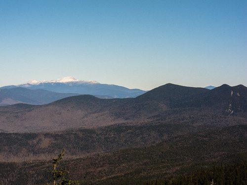 Mount Washington and the Tripyramids by EPICAC, on Flickr 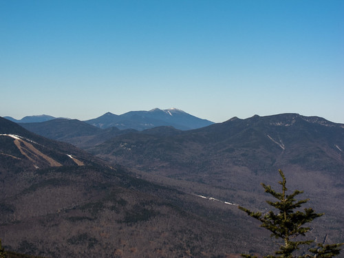 Waterville Valley Ski Slopes, Franconia Ridge, The Osceolas by EPICAC, on Flickr  Drake's Brook by EPICAC, on Flickr
|
 #
¿
Dec 17, 2012 22:34
#
¿
Dec 17, 2012 22:34
|
|


|

|
| # ¿ May 3, 2024 23:04 |
|
|
Miron posted:I drove over to New Hampshire yesterday and hiked up Owl's Head. The total trip was 17 miles with a bushwack that saved us some distance and a couple tough stream crossings. Given the weather I wasn't expecting to meet anyone else but we came across another group just before the summit. We took the slide up and they did a bushwack straight up through the dense spruce. I'm not sure which of us made the worse choice. We joined up with them for the rest of the hike which was fun. Are you working on the New Hampshire 4000 footers? Everyone my wife and I saw and talked to when we hiked Owl's Head last June were working on the list (ourselves included). I thought it was a fun hike, even if it's long and the only real views are from the slide. Did you do the bushwhack from the Black Pond Trail? We took that route when we did it. Apparently there's a herd path that you can follow for much of the route. We lost it, and ended up trending too far west. Our descent back down to the trail was a miserable slog through thick spruce. We opted for the stream crossings on the way back. I've read about another bushwhack that bypasses the slide that's commonly used in the winter, I wonder if that's what the other group took. Apparently both whacks are commonly used enough and easy to follow in the winter once they get packed down by snowshoes.
|
|
#
¿
Dec 18, 2012 18:21
|
|
|
BeefofAges posted:Microspikes rule. My Microspikes are the single most used piece of non-clothing winter equipment that I have (if you count gaiters as clothing). If there's packed snow or ice on the ground I'm likely wearing my Microspikes. Even if the trail is packed snow, I like the extra traction that they provide Last winter I used my microspikes every hike, and wore them most of the time. My snowshoes got a little bit of use, but NH didn't get a lot of snow last year so they mostly stayed on my pack or in the car. I used crampons once, for some steep, icy bulges on one section of trail.
|
|
#
¿
Jan 2, 2013 20:35
|
|
|
My wife and I hiked Mount Starr King (3907') and Mount Waumbek (4006') in Jefferson, NH on Saturday (7.8 miles, 2900' elevation gain). High winds in the forecast kept us from picking a more exposed hike. Temps were in the low 20s, and it was breezy, but not too bad. There was a pretty good snowshoe track to follow. It was still a bit soft, so we wore our snowshoes most of the way. I loved the snow/ice encased trees up high.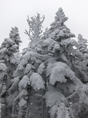 Snow encased trees by EPICAC, on Flickr  Starr King Trail by EPICAC, on Flickr 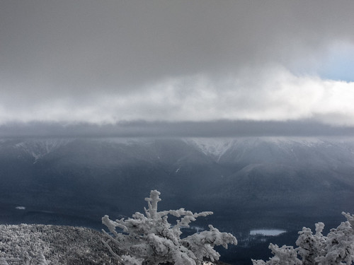 The Presidentials in the Clouds by EPICAC, on Flickr
|
|
#
¿
Jan 7, 2013 18:33
|
|
|
Went on a trip with my employer's (a university) outing club on Sunday. We went up Mount Hight and Carter Dome in New Hampshire. The weather was unusually warm for this time of year (temperatures were in the mid 40s). The trip leaders made the mistake of not having all of the participants bring/rent snowshoes, so most people ended up postholing once the temperatures warmed and the snow became slushy. I'm glad I had my snowshoes. Aside from the unseasonable temperatures, the weather was great. There were great views from Hight, and some good views from a lookout on Carter Dome. The snow was mostly too soft to glissade on the way down, except for a steep section descending into Carter Notch.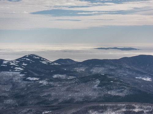 Undercast by EPICAC, on Flickr 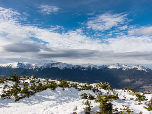 The Northern Presidentials by EPICAC, on Flickr 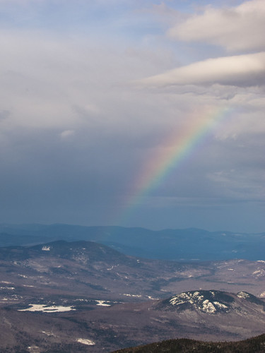 Rainbow from Carter Dome by EPICAC/url], on Flickr [url=http://www.flickr.com/photos/41566708@N08/8385532810/] 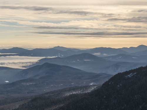 Descent to Carter Notch by EPICAC, on Flickr 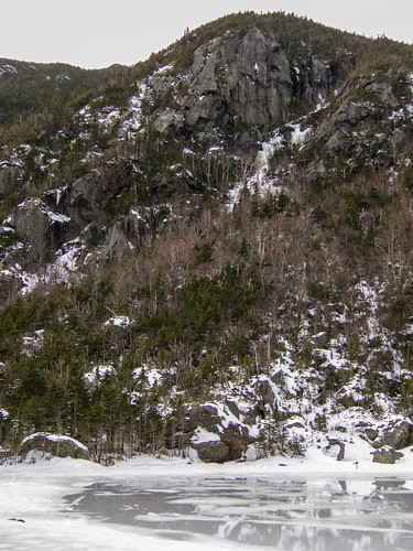 Carter Lakes by EPICAC, on Flickr
|
|
#
¿
Jan 16, 2013 19:04
|
|
|
Did another Outing Club trip last weekend. We did a loop over Mount Lafayette and Mount Liberty (New Hampshire) going up the Old Bridle Path, and down Falling Waters Trail. I'd been wanting to do this hike in the winter for awhile, but my wife prefers shorter hikes in the winter, and want me hiking solo above treeline in the winter. I jumped at the opportunity, when this trip was posted. Below treeline there was a good bit of snow, but cover was patch above treeline. There was some harpack, sporadic patches of ice, some snow drifts, and a lot of exposed rock. Still a fun day. Eagles Lake and Lafayette by EPICAC, on Flickr 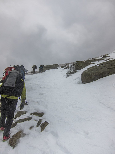 Climbing Lafayette by EPICAC, on Flickr 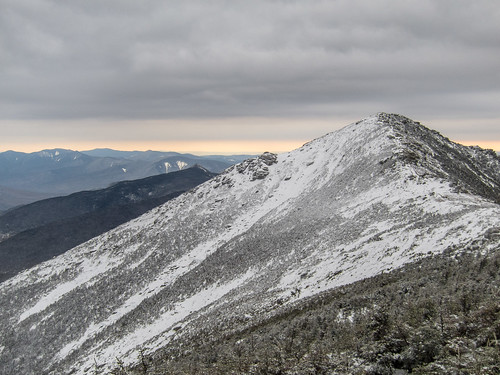 Mount Lincoln by EPICAC, on Flickr 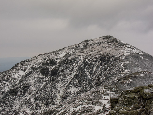 Mount Lafayette by EPICAC, on Flickr  Mount Lincoln by EPICAC, on Flickr
|
|
#
¿
Jan 24, 2013 17:01
|
|
|
I got my last hike of calendar winter in yesterday (I'll be out of town the last two weekends of the season). I did North and South Kinsman (New Hampshire) using Lonesome Lake, Fishin' Jimmy (AT), and Kinsman Ridge Trails (AT). It was a pretty warm day. Temps were about 25şF at the hut, and maybe around 15şF/20 mph winds on the summit of South Kinsman. The peaks were in the clouds, so the views were non-existent, but the rime-covered trees totally made up for the lack of views. I left the hut at the same time as another solo hiker, John, and we ended up hiking together the rest of the day. It's always great meeting people out on the trail. On the way down we passed Randy Pierce, a completely blind hiker, and his support team heading up.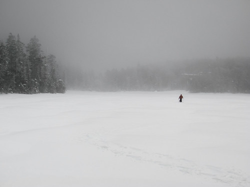 Lonesome Lake by EPICAC, on Flickr 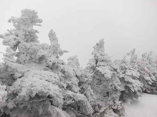 Rime-Covered Trees by EPICAC, on Flickr 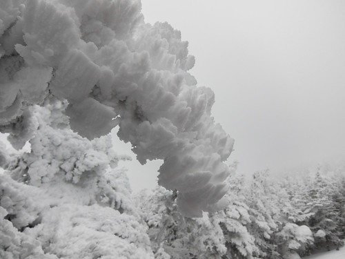 Rime-Covered Trees by EPICAC, on Flickr 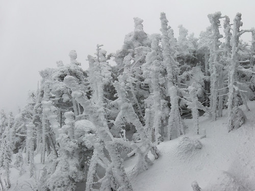 Rime-Covered Trees by EPICAC, on Flickr 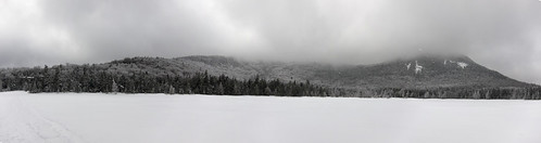 Lonesome Lake by EPICAC, on Flickr
|
|
#
¿
Mar 4, 2013 03:18
|
|
|
What kind of water treatment do you guys recommend? All of my backpacking to date has been during the winter, and we melted snow for water. I spend most of my time in the White Mountains in NH.
|
|
#
¿
Apr 17, 2013 20:22
|
|
|
A Kpro posted:Another weekend, another mountain. It's Mt McCaleb, pretty much in the middle of Idaho Smoove J posted:Top of Mt Rockwell, left to right we've got Statuary, Church, Vigil, Mt St Nicholas, Battlement & Caper at the far right. I've climbed all except for Church, Vigil & St Nick... Save me jeebus posted:Finally did Bierstadt-Sawtooth-Evans I'm insanely jealous of those oh you who get to hike mountains like these on a regular basis!
|
|
#
¿
Aug 20, 2013 22:05
|
|


|
My wife and I finished the New Hampshire 4000 footers on Zealand and the Bonds the weekend of September 28th. We set up a car spot at Lincoln Woods, and got a ride to the Zealand Trailhead. On day one we hiked over Zealand, to the Guyot Campsite, set up our tent, and then headed up to West Bond for sunset. On day two we hit Mount Bond, and Bondcliff, then hiked out back to our car. The weather was perfect, the fall colors were great, and the views were incredible. A total of 22 miles and 5200' of elevation gain. IMG_5861 by EPICAC, on Flickr  IMG_5868 by EPICAC, on Flickr 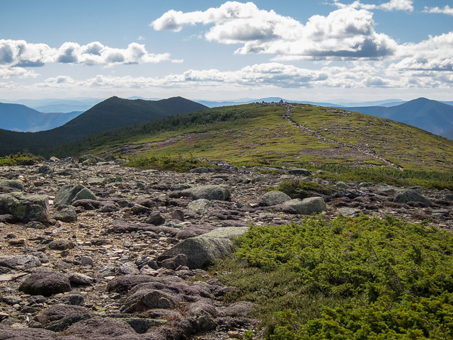 IMG_5887 by EPICAC, on Flickr 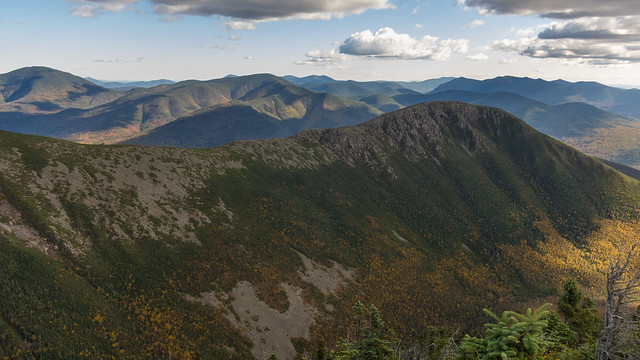 IMG_5900 by EPICAC, on Flickr  IMG_5926 by EPICAC, on Flickr 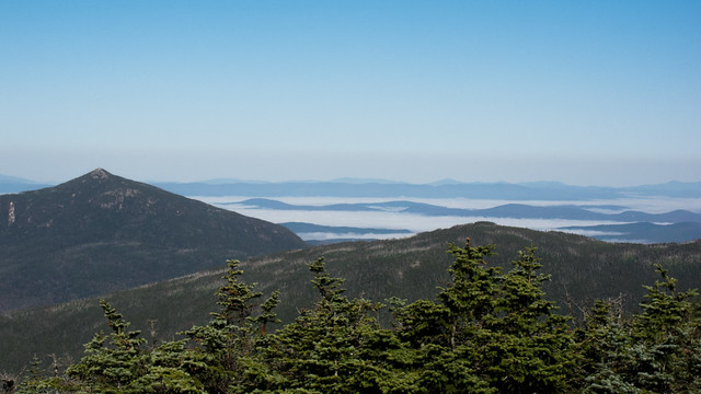 IMG_5955 by EPICAC, on Flickr  IMG_5993 by EPICAC, on Flickr
|
|
#
¿
Oct 8, 2013 18:37
|
|
|
My mother-in-law has planned a visit to Yosemite for a couple of days after Christmas. I'm looking for some recommendations for day hikes. I'm pretty sure my in-laws will be hiking as well. They're in their early 60s, but are fairly active: recreational biking, camping (shortish hikes in to campsite), snowshoeing, easy hikes in the area. We'll have snowshoes and micro spikes for traction. Does anyone have a recommendation for and easy/moderate hike if the in-laws come (~5 miles), or a more strenuous hike for my wife and I if the in laws sit out (up tp 10 miles)?
|
|
#
¿
Dec 20, 2013 18:01
|
|
|
I'm looking for a recommendation for some shell pants. I've been using a pair of Marmot Precip pants for the last two seasons, and while they're starting to delaminate in a couple of spots, I could probably get another couple of seasons out of them. However, they always tended to work their way down while hiking, and I've dropped an inch or two in the waist since last spring. So I'm afraid the problem will be worse this year. I'm also not crazy about the velcro waist closures. I had a pair of Gore-Tex pants from EMS before these that I liked the fit of, but I returned them because they were insanely fragile.
|
|
#
¿
Jan 8, 2014 22:43
|
|
|
I'm looking for some recommendations for hikes in Colorado. I'll be attending a conference at the Snowmass Base Village Conference center form June 22-27. During the week, I'll have the afternoons free from 12:30-4:00, and won't have transportation. I was hoping for a few recommendations for hikes that could be reached on foot from the base village, and completed in about 3-4 hours, preferably something that will get me some elevation gain for acclimatizing. After the conference is over, I was planning on renting a car on Friday and driving somewhere for a longer hike on Saturday. Then driving to Denver after the hike, and flying out on Sunday or Monday. I was hoping people had a recommendation for a good 14er to start with that would be generally between Snowmass and Denver, not too long (=<12 miles), and a trail with a fair amount of traffic (at the request of my wife since I'll be solo). I was planning on crashing in the car at whatever trailhead on Friday night, so an early start isn't a problem. Also, what can I expect in terms of snow, weather, etc the last weekend in June? What kind of gear do I need to bring?
|
|
#
¿
Apr 10, 2014 19:52
|
|
|
Discomancer posted:Mt. Bierstadt is relatively close to Denver and is a pretty easy day hike with a good amount of foot traffic. In June you can have any kind of weather on a 14er, it will probably be windy and a little cold, lots of UV, possible rain or snow. Bring enough water for the whole trip, don't expect to be able to fill up along the trail. Plus, you may see mountain goats there! Thanks, I'll look into Bierstadt. How are Grays and Torreys when combined? Depending on what day I fly out, I might try for two hikes. Waters not an issue. I'm paranoid about running out, and have been carrying about twice what I need all winter. I assume snow conditions can be quite variable from year to year depending on the snowfall. Any suggestions for resources for trail conditions etc? Will I need to brink along my crampons/microspikes/ice axe? (Packing more stuff isn't an issue since my employer will be paying for any baggage fees).
|
|
#
¿
Apr 11, 2014 16:50
|
|
 easy 14er.
|
Mr. Powers posted:On the way down Sunday, in the rain, we saw countless people covered in cotton head to toe (khakis and polo shirts) starting the 4 mile hike up to Lafayette, with a forecast high of mid 40s. Last Sunday (the 10th) some friends and I did a single day Presidential Traverse. The weather was beautiful for most of the day, but about halfway between Mount Pierce and Mount Jackson we started to hear thunder. We hurried over the summit of Jackson, and got below treeline as fast as possible. We were back in the trees for 10 minutes, with about 2.5 miles left of 22 miles total, and it started dumping. At first it was rain, then cranberry sized hail. This section of trail is pretty steep and rocky, and we were descending through a flowing river of hail. Getting soaked, and pelted with hail sucked, but the trail was manageable with caution. We'd probably made it down a mile when we ran into two college age women standing on the trail. One pack between the two of them, only one had a poncho, the other was wearing a sweatshirt. It's around 6:15-6:30 PM by this point. Them: Hi, we don't know what to do. What should we do? Me: It's a lot worse higher up, and the summit is exposed, you should go down. Them: But, we're afraid of slipping if we go down. And what do we do if it gets dark? Me: Well, you just need to be careful descending, but you really should turn around. Them: How far are we from the summit? Me: You're probably about a mile from the summit, but you shouldn't go up. The weather is worse, and you have further to descend. Them: But it was so nice and then it just suddenly started, and we were having fun. Me: You really should go back down. We started back down, and they were just standing there. One of my friends yelled back at them that they should turn around. I'm not sure what they did, but I never saw any news of a rescue so I assume that they were fine in the end. I just can't imagine thinking it's a good idea to keep heading to the top in the middle of a hail storm when you're so unprepared.
|
|
#
¿
Aug 19, 2014 15:26
|
|
|
Suicide Watch posted:http://nhpr.org/post/new-york-hiker-found-dead-white-mountains I'm willing to hike in the cold, but if the winds are too high I won't go above treeline. I hiked Mt. Carrigain, NH with some friends on Saturday. It was cold (highs ~7şF), but the wind wasn't a factor while we were on the mountain. The sketchiest part of the whole day was the drive back to Boston that evening. I93 was basically covered with packed snow between Concord, NH and Boston, and this was before the brunt of the storm hit. I can't imagine why anyone would have gone out on Sunday. From the news coverage and her Facebook account, at first glance she seemed to have had some mountaineering experience (Elbrus & Kilimanjaro). Perhaps she underestimated the hike because of the relatively low elevations. It sounds like she was planning a single day traverse of the Northern Presidentials (Madison, Adams, Jefferson, and Washington). I'm not sure what her planned route down Washington was, but getting to the summit from the main trailhead for Madison & Adams is about 11 miles, and 7500' of elevation gain. If she was planning on descending via the Jewell trail, she would have been planning a 16 mile day. The reports say that her husband dropped her off at the trailhead at 5:00 AM, and she activated her beacon at 3:30 PM. Her body was reportedly recovered near Star Lake, which is in the col between Madison and Adams. I wonder why she didn't turn back sooner given her pace, especially since she was probably slowed by the fresh snow that had fallen the night before. Assuming that she had summited Madison, she had only covered about 5 miles only 1 mile of which was above treeline (with 6 more miles to Washington). Maybe she'd summited Adams as well, and was trying to retreat. If she was found near Star Lake, she would have been less than half a mile over flat terrain to the Valley Way trail, which quickly gets you into the relative shelter of the trees, from there it's less than 4 miles to the trailhead. Maybe she was disoriented, maybe she was injured. Of course this is all speculation. The conditions were brutal Sunday night/Monday morning. The Mount Washington Observatory recored a temperature of -35şF, with wind chills around -90şF, and maximum gust of 141 mph, with sustained winds of 100 mph. There's video of the S&R, at around 0:20 you can see two people get blown off of their feet: https://www.youtube.com/watch?v=DP4u6VyrgCk
|
|
#
¿
Feb 17, 2015 18:59
|
|
|
Levitate posted:I'd imagine it's the usual story of being indecisive about when to turn back and not thinking it's that bad until it's too late. Also maybe already disoriented at that point. A SAR guy posted some photos & comments on a New Hampshire hiking Facebook group. It sounds like a fall might have been responsible. SAR Guy posted:she was in the wrong place at the wrong time, and alone. It seems she fell, possibly wandering around up there, hypothermic. It's impossible to know for sure. His photos: https://www.facebook.com/NHTramper/media_set?set=a.10153650619858957.1073742059.671133956&type=1 A photo of the recovery location: https://www.facebook.com/photo.php?fbid=815760191794914&set=p.815760191794914&type=1 Another view of the recovery location from Mount Madison, I think it's the outcropping just to the left of center: https://www.facebook.com/photo.php?fbid=1717884185694&set=a.1717809423825.2090004.1195934365&type=1
|
|
#
¿
Feb 18, 2015 02:22
|
|
|
I'll be in the South LakeTahoe area next week, and was scoping out a couple of peaks. I was wondering if anyone here had any useful beta on either of the hikes. Number one on my list is Mount Tallac via the SE Chutes Route. Since this involves off trail travel I'm interested in any route finding beta. Specifically, finding the spot where you leave the trail, and also finding your way up the chutes. The route description doesn't give much detail, and the photo of the route on the page above shows the lower part very well, but not the chutes themselves. The other is Pyramid Peak in the Desolation Wilderness. I was considering the Rocky Canyon Route up that leaves from rear Strawberry/Twin Bridges. Any beta on that trail?
|
|
#
¿
Jul 2, 2015 18:05
|
|
|
alnilam posted:Please recommend me a 2 or 3 night backpacking trip in driving distance from Sacramento, CA! You should check out the Desolation Wilderness, near Lake Tahoe. Beautiful, rugged scenery. Here are some photos from a few years ago. I did a day hike up Ralston Peak on the edge of the wilderness. I've always wanted to make it down into the basin to hike around Lake Aloha but haven't had the chance. I just got back from Tahoe, and did a day hike up Pyramid Peak, which you can see in some of the photos from the Ralston Peak album. Haven't had a chance to process those photos yet. You can self permit for day trips, not sure about overnights. https://flickr.com/photos/41566708@N08/sets/72157627249003515 EPICAC fucked around with this message at 01:33 on Jul 15, 2015 |
|
#
¿
Jul 15, 2015 01:27
|
|
 I'm from a land where nobody at all backpacks so there's no such thing as permits "running out," this idea is foreign to me.
|
For the poster who asked about backpacking near Sacramento. Here are some pictures from my hike up Pyramid Peak in the Desolation Wilderness. It's a day hike, but I think there are good options in Desolation Valley, which is the lake filled valley you can see in some of the pictures. I think the easiest access point is the PCT from Echo Summit. You can also take a ferry across Echo Lake that will drop you off further in, and save some hiking distance if that appeals to you. https://www.flickr.com/photos/41566708@N08/sets/72157655638851359  Lover's Leap by EPICAC, on Flickrkr 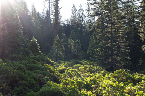 IMG_0876 by EPICAC, on Flickr 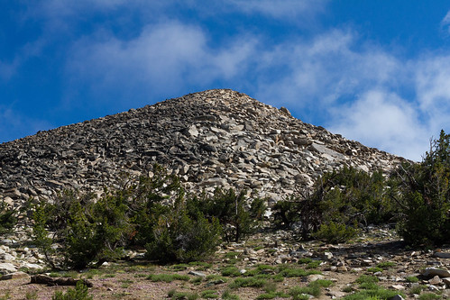 Pyramid Peak Summit Block by EPICAC, on Flickr 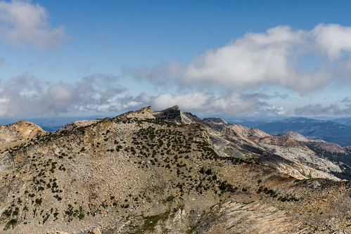 Mount Agassiz and Mount Price by EPICAC, on Flickr 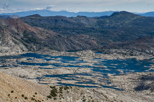 Lake Aloha by EPICAC, on Flickr 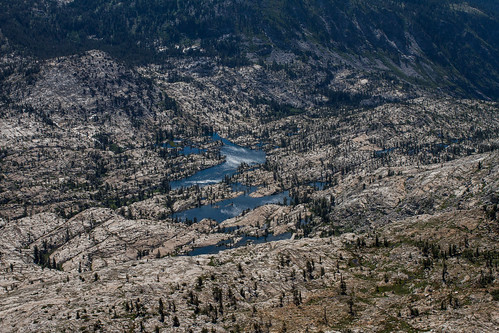 Gefo, Toem, and Ropi Lakes by EPICAC, on Flickr EPICAC fucked around with this message at 18:34 on Jul 26, 2015 |
|
#
¿
Jul 26, 2015 18:30
|
|
|
alnilam posted:That's exactly why I use a pump - being able to pump a trickle or a puddle has saved my rear end a few times. But if you know your water sources and you know that won't be an issue, gravity filters work great When I was there in early July the streams were flowing. I could hear the stream in Rocky Canyon during my hike, and Pyramid Creek was flowing behind my wife's family's cabin. This was after a week of rain, but from what others in her family have said Pyramid Creek has been flowing all summer.
|
|
#
¿
Aug 17, 2015 18:15
|
|
")
|
talktapes posted:Yesterday I finished up the 48 4k New Hampshire list on Mt. Moriah. Congrats! I'm currently working on finishing the winter 48. I'd like to finish this winter, but I don't thin it's likely since we have a one year old at home. I'm not able to get out most weekends like I was in the past. Plus I've left myself with some difficult peaks for the finish. I should be able to get Moosilauke and the Osceolas this winter, but completely time and weather dependent are Zealand and the Bonds, and Monroe, Washington, and Jefferson. We took our baby up to Lonesome Lake Hut on Friday, and I'm getting the itch.
|
|
#
¿
Nov 29, 2015 18:28
|
|

|
Made it to New Hampshire for my first 4000 footer since last winter. I did Moosilauke via the Glencliff Trail. It was a beautiful day, great views from the summit. That's 39/48 on the NH winter 4000 footer list. I'll get to 41 this winter (The Osceolas), but the last 7 peaks are Washington, Monroe and Jefferson and Zealand and the Bonds. So I'm not sure if I'll get a weather window for the Presidentials, or have the time to get in the long Zealand & Bonds hike.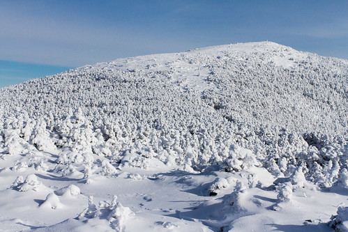 IMG_1137 by EPICAC, on Flickr 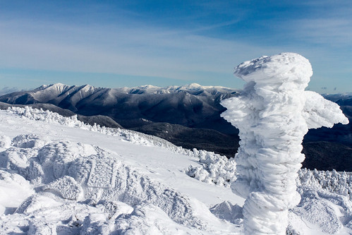 IMG_1155 by EPICAC, on Flickr  IMG_1159 by EPICAC, on Flickr
|
|
#
¿
Jan 18, 2016 04:51
|
|
|
Levitate posted:hike naked to cut down on cloths weight If you do this aerodynamics becomes a HUGE factor, you'll need a full body shave to really get the full benefits. Plus, depending on how hairy you are, you'll save a few ounces too.
|
|
#
¿
May 11, 2016 17:07
|
|
|
Internet Explorer posted:+1 for "have Osprey pack and Osprey hydration bladder, works great" I'll be the dissenting voice here on Osprey hydration bladders. I love the design of the bladders compared to the camel back bladders that I own, but they just don't have the durability. In April of 2015 I bought a small Osprey pack for run commuting that came with a 2.5L bladder. I used it to commute about 3X a week, and for water on longer runs when it was hot (20-35 miles). It sprung a leak on a run in the first week of June, the seam came undone at the very bottom of the bladder. I got a replacement bladder from REI the next week, and used it with the same frequency. It sprung a leak in the same location the first week in September about 5 miles into an 18 mile run. I contacted Osprey CS, and was told this was a known issue that they were trying to fix. Maybe they hold up better for hiking, but they're not cut out for running.
|
|
#
¿
May 20, 2016 17:59
|
|
|
bongwizzard posted:I cannot even imagine going back to a tent after getting used to my hammock. It is so nice I have found myself wishing for it when stuck in lovely hotels. I've read a bunch of comments like this heaping praise on hammocks, but it seems like it would only be comfortable if you're a back sleeper. I'm a stomach sleeper, and can't imagine a hammock would work for me. Is it possible to comfortably sleep on your stomach in a hammock?
|
|
#
¿
Aug 30, 2016 20:23
|
|
|
FireTora posted:Yeah, was pretty windy late morning/early afternoon Saturday for the upper half from Castle Rock. Stayed dry besides the occasional misting though. Since there was so much fog we just pushed through and got to Waterman Gap fairly early and got set up before the rain. It started raining around 7 pm, we left camp around 10 am and got to Big Basin HQ around 2:30 with the rain only varying from light to pouring the entire time. All our rain pants and jackets had completely soaked through by the end but we had a great time. I think the trail from Waterman to Big Basin was prettier overall but the fog on Saturday left no view. I've been fixated on this trail since it was posted earlier in the thread. We're visiting my wife's family in San Jose over Christmas, and I really want to run this in a single shot. I just need to convince someone to drop me off and pick me up. How was the footing? The pictures all make it look pretty smooth, but it's hard to get a sense from just a few photos.
|
|
#
¿
Oct 18, 2016 02:22
|
|
|
A perfect weather forecast on Friday, and the need to distract myself from the inauguration prompted me to take a vacation day and get to the mountains. I've been working on the winter New Hampshire 4000 footers for the last few years, and want to finish this year. I managed to cross Washington, Monroe, and Jefferson off the list with a 12.5 mile hike with about 5100' of elevation gain. Now I just need Zealand and West Bond (a 23 mile day!). The weather was absolutely perfect. It was sunny with clear skies, and an undercast down in the valleys. Visibility was great, I could see Mount Mansfield, Camel's Hump, and Ellen and Abraham in Vermont. Temps were in the low 30s, and there was only a light breeze on the summits. The average wind speed for Mount Washington in January is 46 mph. Conditions were mixed, I used every form of traction I brought, microspikes, snowshoes, and crampons. Full Album Strava Link 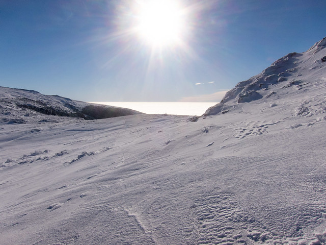 Monroe-Washington Col by EPICAC, on Flickr 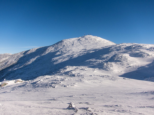 Washington from Monroe by EPICAC, on Flickr 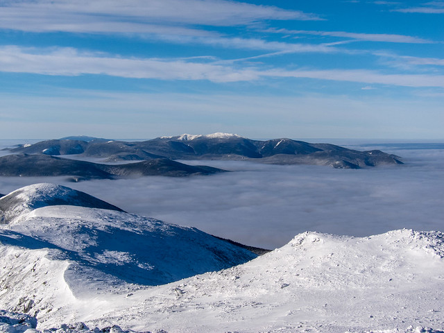 Francoia Ridge in the Distance by EPICAC, on Flickr 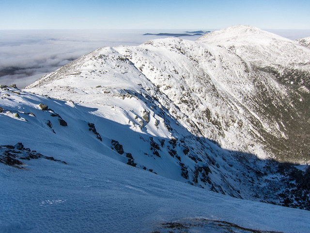 The Great Gulf by EPICAC, on Flickr 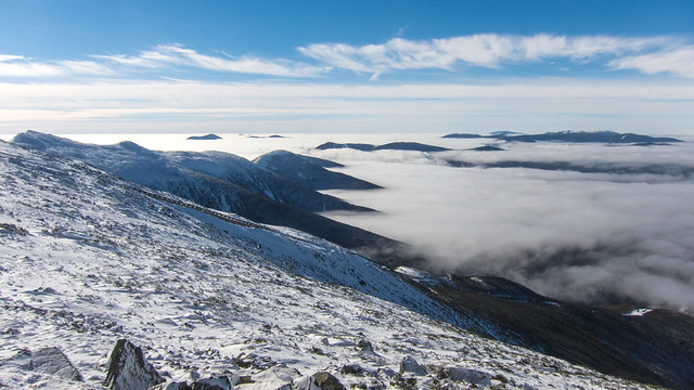 Ridges and Undercast by EPICAC, on Flickr 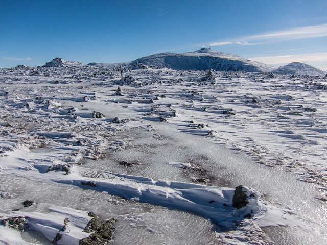 Monticello Lawn by EPICAC, on Flickr 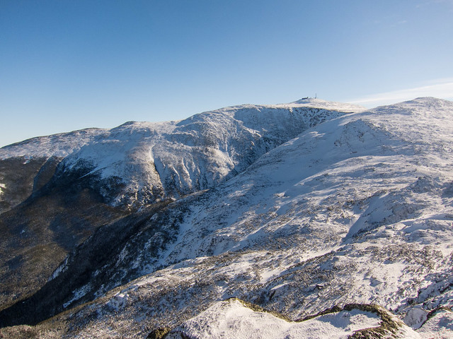 Mount Washington by EPIAC, on Flickr
|
|
#
¿
Jan 22, 2017 00:58
|
|
|
Hughmoris posted:Awesome pictures! Were you the only one up there? I think the weather was too nice to have the mountains to myself. I saw about a dozen other people, but the lot was full when I got back to my car. I hiked the first hour with a woman who left the parking lot when I did, and ended up hiking the ridge from the summit of Monroe to Jefferson with a another guy and his dog.
|
|
#
¿
Jan 22, 2017 02:37
|
|
|
Hughmoris posted:What (if any) type of smart devices do you hike with? I currently just have an Android phone but I'd like to start logging my hiking routes, distances etc... Being new to the scene, I really don't know what type of features work well for hiking. I used to use an app on my iPhone with downloadable topo maps for the lower 48, but they stopped supporting it. I liked the ability to see your position on the map. Currently I use a Garmin 230, which I primarily have for running. It doesn't have maps functionality, but I have the "Other" activity set up for hiking the first screen has distance, time, and current elevation fields. The second screen has lap distance, lap time and current elevation fields. I hit the lap button at every trail junction. Combined with study of a map before a hike, and consultation during, it's usually enough to roughly place myself. I have my Garmin Connect account synced with Strava, which is what I use to keep track of my runs/hikes/etc. 
|
|
#
¿
Jan 22, 2017 19:54
|
|
|
Hughmoris posted:Also, being new to hiking, what is the etiquette when meeting people on narrow trails? Does the person heading downhill typically have the right away, or the person heading uphill? Or does no one really give a poo poo either way? I'm not sure what the etiquette is, but typically when I'm going uphill I'm happy to yield to downhill traffic, and it seems that when I'm going downhill most uphill hikers are happy for a short break.
|
|
#
¿
Feb 18, 2017 23:46
|
|
|
Until a couple of weeks ago I would have said Hale was my least favorite 4K, but I ran a loop over the Twins, Zealand, and Hale. I really liked the Lend A Hand Trail from Zealand Falls Hut, and descending via the Firewarden's Tail was fun. Both are much more interesting than the short way up. I've finished both the regular and winter list, and I think running them will be my next project. I think that will allow chaining some peaks together into interesting loops, and some alternate approaches. I think that will actually make Owl's head fun since it's a nice flat approach. I've knocked out 6 this month, but that was because my wife and toddler were out of town two weekends in a row.
|
|
#
¿
Jul 28, 2017 00:54
|
|
|

|
| # ¿ May 3, 2024 23:04 |
|
|
Rob Rockley posted:So I’m finally going to Idyllwild in a couple weeks for an isolated staycation, going to try and climb Mt. San Jacinto from there. Biggest climb I’ve ever been on was from sea level to about 7000’ with no ill effects. I’m planning on waiting a couple days there(about 5000’) before climbing, but for someone who’s never gone near 10,000 feet before how much misery should I expect up there with altitude issues? It’s highly variable person to person. 10,000’ after only a couple of days at 5000’ might be rough, it might not. I live at sea level, and do most of my hiking at low elevations. My wife’s family has a cabin near Lake Tahoe at around 6100’. I have no issues going there directly from sea level. I’ve gone up to 9200’ the day after arriving at there. My only issue was that the hike seemed like extra effort. No headaches or anything, just felt hard. Another time I went to a meeting in CO, and went from sea level to staying at 8400’. In that case walking uphill from the conference site to my hotel was noticeably difficult, and I had mild headaches for a day or two. After 5 days, I did a couple of 14ers, and only noticed the altitude once I got up around 12k, again in that case it only felt harder than usual.
|
|
#
¿
Sep 5, 2020 00:01
|
|