


|
Senor Dog posted:Maybe that�s because the Midwest is a geographic concept despite your desperate attempts at turning it into some elitist shot at poor rural people? ouch
|
 #
?
Sep 20, 2018 23:43
#
?
Sep 20, 2018 23:43
|
|


|

|
| # ? Jun 4, 2024 18:35 |
|
|
Buffalo and Rochester are on a Great Lake, which is something
|
|
#
?
Sep 21, 2018 12:56
|
|

|
tractor fanatic posted:Buffalo and Rochester are on a Great Lake, which is something Oh, is that what I've been smelling all these years?
|
|
#
?
Sep 21, 2018 14:53
|
|


|
I missed American chat but I think you should use the Australian term "Seppo," which evolved from septic tank.
|
|
|
#
?
Sep 22, 2018 02:38
|
|


|
UnfortunateSexFart posted:I missed American chat but I think you should use the Australian term "Seppo," which evolved from septic tank. https://en.wikipedia.org/wiki/Seppo_K%C3%A4%C3%A4ri%C3%A4inen
|
|
#
?
Sep 22, 2018 09:17
|
|

|
Please 
|
|
#
?
Sep 22, 2018 14:10
|
|

|

|
|
#
?
Sep 23, 2018 18:11
|
|

|
Squalid posted:lol, where are you getting this data? http://worldmap.harvard.edu/maps/2962/ and https://worldmap.harvard.edu/maps/chinaX have a whole bunch online and there's tons more data that I haven't really figured out how to make sense of here: https://sites.fas.harvard.edu/~chgis/data/chgis/v6/ relatedly, here's a map of the Central Plains vaguely around the time of the Qin Dynasty (that I haven't finished): 
|
|
#
?
Sep 23, 2018 18:14
|
|

|
Feels a bit weird to list Royal Dutch Shell, a company still primarily headquartered in The Hague, as just a British company despite the large amount of British ownership.
|
|
#
?
Sep 23, 2018 18:36
|
|

|
Is it just me or does the Chinese symbol not appear on the map? And what does "persistent colonial influence" actually mean? South Africa wasn't much of a colony since well before WW2.
|
|
#
?
Sep 23, 2018 21:46
|
|

|
Eh, there was technical independence, but there were enough Anglo-Africans who signed up for WW2, and black South Africans who one way or another got signed up for WW2, that it was still clearly under imperial influence. The 1948 election of the National Party and the 1960 referendum to implement their even worse ideas would be the points where I'd say there was no longer persistent colonial influence.
|
|
#
?
Sep 23, 2018 21:52
|
|


|
E: checked my facts, I was wrong.
|
|
#
?
Sep 24, 2018 04:22
|
|

|
Teriyaki Hairpiece posted:E: checked my facts, I was wrong. Excuse me this is D&D, we don't allow this sort of thing here.
|
|
#
?
Sep 24, 2018 04:26
|
|


|
Grand Fromage posted:Excuse me this is D&D, we don't allow this sort of thing here.
|
|
#
?
Sep 24, 2018 08:09
|
|

|
Count Roland posted:Is it just me or does the Chinese symbol not appear on the map? In the case of France and for sub-Saharan Africa it means they still all but own your rear end. See: https://thisisafrica.me/france-loots-former-colonies/
|
|
#
?
Sep 24, 2018 08:16
|
|

|
Orange Devil posted:In the case of France and for sub-Saharan Africa it means they still all but own your rear end. See: https://thisisafrica.me/france-loots-former-colonies/ Yeah I know France routinely sends troops/bombs to many of its former colonies. That's why I found it weird South Africa was apparently being lumped into the same category.
|
|
#
?
Sep 24, 2018 13:40
|
|
|
More interesting is how Mozambique isn't in the British zone of influence, they were never in the Empire, but they asked to join the Commonwealth and basically tie their development goals to decision making groups that have 'former British colony' as their common history. That sounds closer to a British influence than whatever they're alleging is happening in Somaliland.
|
|
#
?
Sep 24, 2018 14:09
|
|
|
It looks like it wasn't attempting to make those influence borders any deeper or more accurate than "former Empire, greatest extent (+ Libya).
|
|
#
?
Sep 24, 2018 15:03
|
|

|
Wasn't this very idea brought up in the thread recently? 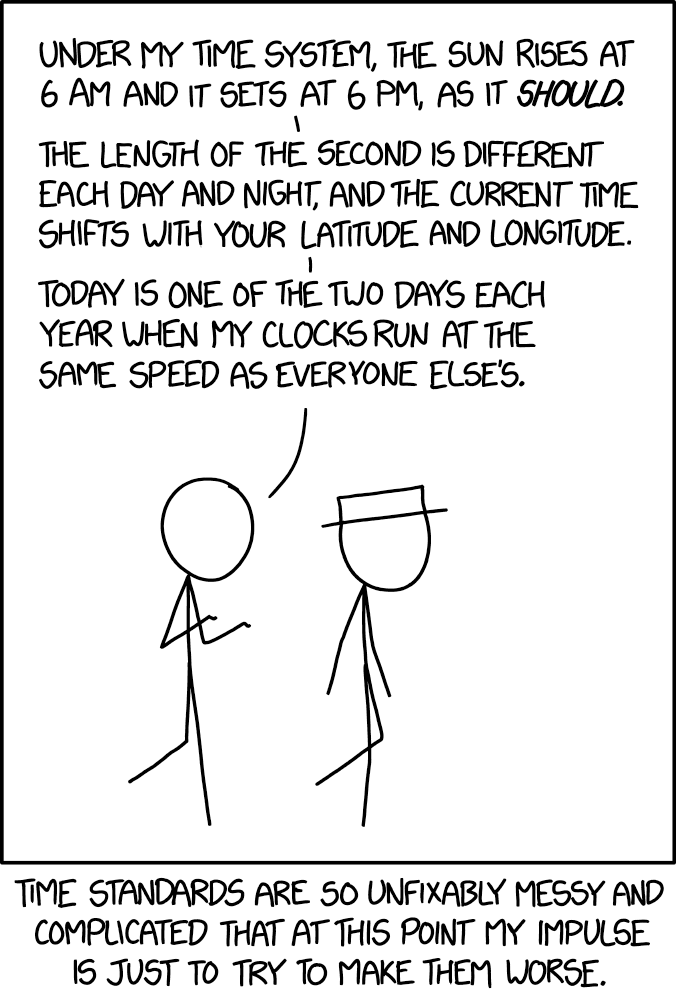
|
|
#
?
Sep 24, 2018 22:55
|
|
|
yeah but remember: 
|
|
#
?
Sep 24, 2018 23:28
|
|

|
Count Roland posted:Wasn't this very idea brought up in the thread recently? time worked like this in premodern Japan. Well not every day and night, but each season had different hours. There's some pretty neat clocks from the Meiji period where the mechanisms are accounting for that.
|
|
#
?
Sep 25, 2018 02:04
|
|
|
Guavanaut posted:More interesting is how Mozambique isn't in the British zone of influence, they were never in the Empire, but they asked to join the Commonwealth and basically tie their development goals to decision making groups that have 'former British colony' as their common history. It's not all that surprising regarding Mozambique, just look at a map of former colonial possessions. They're entirely surrounded (land wise) by former British holdings. It's the kind of move that theoretically I guess better integrates them with the neighborhood economically and so on. As for Somaliland, it was also a former British colony. The rest of Somalia was Italian.
|
|
#
?
Sep 25, 2018 02:24
|
|

|
Count Roland posted:Is it just me or does the Chinese symbol not appear on the map? The apartheid government was a colonial-settler state even after it left the commonwealth, and depending on what one means by colonial influence: most of the resources are still in the hands of the colonizers today. Zimbabwe seems a little weirder, not sure what the criteria are for that, but if it somehow still qualifies then SA would under the same metric.
|
|
#
?
Sep 25, 2018 02:44
|
|

|
Koramei posted:http://worldmap.harvard.edu/maps/2962/ and https://worldmap.harvard.edu/maps/chinaX have a whole bunch online This is a funny site. It looks like some department head made his grad students post all the data, but they got lazy and hosed up the metadata the data dictionary. Still, it's got a lot of good stuff. Just playing around in the browser I put this map of commerce in the Ming Empire together real quick, before the layers all broke:  Trade and piracy in southeast Ming China. Polygons pink-grey: zone of coastal trade during Ming Lines Green: Ming Courier/mail routes (correspond to important roads) Blue: Course of the Yellow River 1368-1855 Pink dashed: Grand Canal (partially concealed by courier routes, I couldn't change layer order) Points blue: Chinese pirate havens purple: Wokou pirate havens Yellow-red: Portuguese trading post black square: Dutch trading post Blue square: Nagasaki (primary Japanese trade depot from 1571 edit: The last link you posted mostly just seems to be the same files set up for easy access and downloading without having to use the map interface. Though it also has some weird time series data of provincial level divisions from the Spring and Autumn period forward. It mostly just has points for them though, and doesn't indicate the level of governance so its not that interesting. It seems to be missing data from another related layer with the polygon boundaries, but that doesn't seem to be available. Metadata/ data dictionary is a hot mess so its hard to tell what they were going for. Squalid fucked around with this message at 03:17 on Sep 25, 2018 |
|
#
?
Sep 25, 2018 03:10
|
|

|
That�s the 6th release I linked to, apparently the 4th has better documentation (and maybe the missing files). I can link to it tomorrow if it�s hard to find. Also what�s wrong with the metadata in the online one (also is it the first or second link, or both, that�s bad)? I�m still new to the world of GIS so I totally missed that. I have some other sources of county locations that have been matching up when I check them though, although their placement for some layers like the tribes are pretty inaccurate or at least overly vague. E: I�m using the ancient data for a project so I would prefer it to not be wrong 
|
|
#
?
Sep 25, 2018 03:48
|
|
|
The metadata is just information about the layers themselves, generally stored in txt or xml file that comes with the other files. If you want to be all professional-like you make sure the metadata stores information like the data source, projection, authors, updates, resolution, and intended purpose. The files on that site have extremely inconsistent metadata which doesn't necessarily mean it has errors or other problems, it just makes it harder to interpret. Unless it really matters if points have a locational precision of 1 meter or 100 m, the absence of good metadata probably isn't important for your project.
|
|
#
?
Sep 25, 2018 04:20
|
|
|
Count Roland posted:Wasn't this very idea brought up in the thread recently? I championed it in the Spaceflight Thread.
|
|
#
?
Sep 25, 2018 06:55
|
|

|
Grape posted:It's not all that surprising regarding Mozambique, just look at a map of former colonial possessions. They're entirely surrounded (land wise) by former British holdings. It's the kind of move that theoretically I guess better integrates them with the neighborhood economically and so on. Meanwhile Namibia was never a direct British colony, it was German, then South African, then there was that whole war, then independent, and yet that gets "persistent colonial influence" from Britain even when it was being held against its will by a state that was suspended from the Commonwealth. And I'm not sure what influence Britain thinks they have in Somaliland, I thought they abandoned the whole area decades ago, while some of the people living there keep saying "hey, come be a soft power over here again so we can have our independence from Somalia respected."
|
|
#
?
Sep 25, 2018 09:35
|
|
|
Guavanaut posted:Yeah but the map has Mozambique as not having "persistent colonial influence", which while it doesn't have a colonial history it does have persisting influence from former British colonies in the area as a Commonwealth member. The map is an attempt to blame everything on the British and French by implying that Royal Dutch Shell is a modern-day East India Company whilst deflecting attention from most (all?) of Africa's current woes being due to rampant unchecked capitalism. It is vitally important that we don't acknowledge that because that's something we could actually Do Something About. It's far cheaper to just apologise and maybe throw half a dozen scholarships at the entire continent.
|
|
#
?
Sep 25, 2018 11:32
|
|
|
It also seems to be there to exonerate China, because they put an icon for the country in the key, but then conspicuously don't use it anywhere.
|
|
#
?
Sep 25, 2018 12:32
|
|
|
Platystemon posted:I championed it in the Spaceflight Thread. Ah, yes of course. I'm glad there's some nerd overlap between these threads.
|
|
#
?
Sep 25, 2018 13:37
|
|
|
The reason why Rwanda isn't shaded in blue, of course, is because Mitterand gave soft support to the Interahamwe during the Rwandan genocide because he thought (not unreasonably) that Kagame and the RPF were getting soft support from Britain. Basically, gently caress colonialism.
|
|
#
?
Sep 25, 2018 20:18
|
|

|
It's because Rwanda and Burundi were awarded to Belgium after the Great War and the map maker didn't give a poo poo about the circumstances in any individual country beyond "was this part of french or british empire"
|
|
#
?
Sep 25, 2018 21:23
|
|
|
On a semi-related note I just read the other day that back in April the king of Swaziland declared the country's name to now be eSwatini, in part to forget about its colonial history (but also in part to distract from the crippling poverty and horrible economy)
|
|
#
?
Sep 25, 2018 21:47
|
|

|
duckmaster posted:The map is an attempt to blame everything on the British and French by implying that Royal Dutch Shell is a modern-day East India Company whilst deflecting attention from most (all?) of Africa's current woes being due to rampant unchecked capitalism. It is vitally important that we don't acknowledge that because that's something we could actually Do Something About. It's far cheaper to just apologise and maybe throw half a dozen scholarships at the entire continent. lol that's a scorching hot take "POST-COLONIAL THEORY IS CAPITALIST PROPAGANDA"
|
|
#
?
Sep 25, 2018 22:28
|
|
|
HookShot posted:On a semi-related note I just read the other day that back in April the king of Swaziland declared the country's name to now be eSwatini, in part to forget about its colonial history (but also in part to distract from the crippling poverty and horrible economy) Before I read about this, I thought he was a crazy person who named the country "electronic Swatini".
|
|
#
?
Sep 25, 2018 23:32
|
|

|
Grape posted:lol that's a scorching hot take Obviously that's not what I'm saying here - or it might be, because I'm not sure what you're saying here. The point I'm making is that the map is implying that these companies are working in tandem with or on behalf of the governments of the countries which used to control them (i.e. Britain or France) which leads to the obvious conclusion that those governments are continuing to control those countries. The fact of it is that these are multi-national corporations and the days of a BP executive sitting in a smoke-filled office in Whitehall receiving instructions from a British government civil servant are long gone. These companies work for their shareholders now, and neither the executives nor those shareholders could give two flying shits about how their decision making affects the current or future prosperity of the country their company is headquartered in. The danger is that a lot of these shareholders - many of which are huge companies with interests in investment, insurance etc - find it very convenient when people correlate BPs actions with those of the British government specifically (or 'The British Institution' in general) because it keeps the heat off of them. In other words, it's much easier to think British Petroleum = A Tool Of The British Government and appropriate blame and criticism accordingly than it is to think Beyond Petroleum Plc = Owned By Investment Banks and Insurance Companies That I Might Be A Customer Of, Oh poo poo and face up to the fact that we might actually all be part of the problem and can't just blame it on the Redcoats or something. BP themselves helped further this idea after Deepwater Horizon in 2010; Obama kept referring to the company as 'British Petroleum' despite the fact they'd rebranded themselves to Beyond Petroleum in 2001. Even more tellingly they'd actually stopped being British Petroleum in 1998 when they merged with Amoco (an American company) and became BP Amoco. That disaster was on a rig run by mostly Americans, in American waters, following American safety standards, but Obama managed to deflect the blame onto 'British Petroleum'; who were quite happy for him to do because it then deflected the blame off their own shareholders and somehow onto Britain. Anyway I'm rambling now. Vive la revolution.
|
|
#
?
Sep 25, 2018 23:54
|
|
|
Managers in London certainly played an important role in causing the Macondo disaster.
|
|
#
?
Sep 26, 2018 00:24
|
|

|
Eh, I doubt BP was ever actually taking instructions from Whitehall in the first place anyway if anything it was the other way around even during the colonial period. I think there is a fair point to say that multi-nationals, while they have no loyalty to any state, nevertheless will take advantage of colonial legacies to gain further advantage. Nevertheless, this advantage is obviously eroding. Also, the map is obviously incomplete/out of date: Sinopec, CNPC an CNOOC all have operations across Africa at this point. quote:In the 2000s China set out to diversify its natural resources imports and ensure energy security amid rapid growth. By 2014, Sinopec alone was active in 16 African countries� Algeria, Angola, Cameroon, Central African Republic, Chad, Egypt, Gabon, Ghana, Kenya, Libya, Mauritania, Niger, Nigeria, Sudan, South Sudan and Tunisia. CNPC is currently active in Tunisia, Algeria, Libya, Niger, Chad, Nigeria, Sudan, and South Sudan; and CNOOC has interests in Gabon, Uganda, Nigeria, Algeria, and Republic of the Congo. https://africaoilandpower.com/2017/07/13/china-makes-inroads-into-african-energy/
|
|
#
?
Sep 26, 2018 01:22
|
|
|

|
| # ? Jun 4, 2024 18:35 |
|
|
Right they�re based out of Canary Wharf not Whitehall.
|
|
#
?
Sep 26, 2018 02:44
|
|