|
https://twitter.com/nuicemedia/status/1470596560824127488
|
|
|
|

|
| # ? May 28, 2024 14:07 |
|
in case you also have no idea where this is: quote:East Nusa Tenggara (Indonesian: Nusa Tenggara Timur � NTT) is the southernmost province of Indonesia. It comprises the eastern portion of the Lesser Sunda Islands, facing the Indian Ocean in the south and the Flores Sea in the north. It consists of more than 500 islands, with the largest ones being Sumba, Flores, and the western part of Timor; the latter shares a land border with the separate nation of East Timor. The province is subdivided into twenty-one regencies and the regency-level city of Kupang, which is the capital and largest city.
|
|
|
|
 Fruitcakes endure the apocalypse.
|
|
|
|
That is one hell of a cake dome
|
|
|
|
why don�t they make the whole house out of the cake dome?
|
|
|
|
The tornado also sucked the doors off the cabinets and left the glassware inside totally unscathed
|
|
|
|
RandolphCarter posted:why don’t they make the whole house out of the cake dome?
|
|
|
|
Platystemon posted:
Total disassociation, fully out your mind Googling "derealization", hating what you find
|
|
|
|
tiberion02 posted:Total disassociation, fully out your mind Hey, what can you say? We were overdue.
|
|
|
|
https://twitter.com/ReportsDaNews/status/1470606351093145600
|
|
|
|
https://twitter.com/Weather_West/status/1470846115884896257
|
|
|
|
No big deal, it'll be in the 60s across southern MN and WI in mid December. Breaking daily records by up to 10F.
|
|
|
|
gee the bubbles sure are starting to get big in this boiling pot
|
|
|
|
Holy gently caress that's a big extreme fire weather polygon to go with it too. And in December? lmfao. https://twitter.com/NWSSPC/status/1470848062541406208
|
|
|
|
Notorious R.I.M. posted:Holy gently caress that's a big extreme fire weather polygon to go with it too. And in December? lmfao. Welcome to Straya!
|
|
|
|
Platystemon posted:
Do not tell anyone that I live like this.
|
|
|
|
haha broken jet stream goes hrrr
|
|
|
|
Jfc I'm on the east side of Denver and it's not gonna be nearly as bad out here but tomorrow is gonna be interesting. It was also windy as gently caress here around when the tornado outbreak happened a few days ago. Good luck to any goons in Iowa where that line of extremely fast moving supercells is supposed to form.
|
|
|
|
OK baizuo posted:Jfc I finally got new siding done from the land hurricane we had last summer so it seems right that we�ll get another super bad storm. I think we�re supposed to have 70mph sustained gusts tomorrow afternoon.
|
|
|
|
https://twitter.com/skydrama/status/1470800204886528004 https://twitter.com/skydrama/status/1470800209688940544
|
|
|
|
 https://mobile.twitter.com/weathertrackus/status/1470639239314427908 Bass clef of death
|
|
|
|
Thoguh posted:I finally got new siding done from the land hurricane we had last summer so it seems right that we�ll get another super bad storm. I think we�re supposed to have 70mph sustained gusts tomorrow afternoon. I had to give up chasing the dream and buy a new roof this summer, still need windows and siding so come on supercell! Translating the forecast into Midwestern. https://twitter.com/AmberAwx/status/1470952261136359425?s=20
|
|
|
|
Casual late night 90mph tornado chase https://twitter.com/ReedTimmerAccu/status/1470930952293605377
|
|
|
|
Notorious R.I.M. posted:https://twitter.com/skydrama/status/1470800204886528004 but think of all that misused profits. where�s the roi?
|
|
|
|
OK baizuo posted:
hahaha Oklahoma did a big stinky poot!! 
|
|
|
|
Mola Yam posted:DO NOT PEEK BEHIND THE CURTAIN OF AMERICAN CAPATALISM
|
|
|
|
OK baizuo posted:
Trouble clef
|
|
|
|
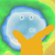
they say its the wind but the map looks to me like the earth being swallowed by lava
|
|
|
|
OK baizuo posted:
Wow! What a time to be ali-
|
|
|
|
Personally I am excited to see a supertornado followed up by a superderecho
|
|
|
|
Notorious R.I.M. posted:Personally I am excited to see a supertornado followed up by a superderecho A hypercane that is spinning so fast it keeps losing its rainbands, just belting out derechos in random directions as they break free
|
|
|
|
Notorious R.I.M. posted:Casual late night 90mph tornado chase What a dumbfuck
|
|
|
|
lol
|
|
|
|
|
Absolute loving demon nation https://twitter.com/nowthisnews/status/1470965085266976779?t=ouM9dNFWQoCPaovyX7Btrw&s=19
|
|
|
|
SirPablo posted:What a dumbfuck he's flying to Omaha in the early morning and then renting a car and driving 120 mph in the dark to chase this line.
|
|
|
|
seems like a dumbfuck thing to do
|
|
|
|
WaryWarren posted:he's flying to Omaha in the early morning and then renting a car and driving 120 mph in the dark to chase this line. What a loving moron
|
|
|
|
https://twitter.com/NWSSPC/status/1470998201922584578quote:The overall intensity of the wind fields with this system are very impressive. Consensus among the guidance is that 500 mb wind speeds will top 130 kt, with 700 mb and 850 mb flow topping 95 kt and 70 kt respectively. Anticipated track of this system coupled with the forecast mass response will result in these very strong dynamics interacting with an at least modestly buoyant warm sector. The expected result is a strongly forced, relatively narrow line of thunderstorms, likely beginning over far eastern NE during the late afternoon/early evening before quickly moving northeastward across IA, southern MN, and much of WI. Given exceptional wind fields, storm motion over 70 kt is possible and significant wind gusts appear likely with any persistent deep convection. These significant severe wind gusts represent the primary hazard, but enough curvature exist within the low-level wind profile for embedded QLCS tornadoes. Any tornadic circulation would likely be transient, given the strongly forced, linear character of the storm mode. Buoyancy will diminish with northeastward extent (into northern WI), likely leading to a reduction in storm strength and overall severe coverage. Even so, the intense wind fields and resultant robust forcing for ascent may result in convectively augmented severe gusts persisting into areas with moderate low-level stability. I'm assuming chasing QLCS tornadoes in this is a meme and any chaser is there to get postmortem damage footage. Notorious R.I.M. has issued a correction as of 07:29 on Dec 15, 2021 |
|
|
|
Going to chase qlcs tors that last four minutes, moving 70+ kt, in the dark. Weak showers are going to produce severe winds by themselves.
|
|
|
|

|
| # ? May 28, 2024 14:07 |
|
OK baizuo posted:
And when the cold front gets too long You must whip it... And when a squall line comes along You must whip it... Notorious R.I.M. posted:Personally I am excited to see a supertornado followed up by a superderecho The Super Derecho was in 2012. The one in August 2020 was effectively a Mega Derecho even if it was never named as such. Next stop? Ultra Derecho.
|
|
|


