|
 
|
 #
?
Jun 13, 2019 19:54
#
?
Jun 13, 2019 19:54
|
|


|

|
| # ? May 27, 2024 14:00 |
|
|
Nebakenezzer posted:So the first transatlantic flight is going to reach its centennial on June 14th - 15th. I've been reading a book on the flight as I didn't know a great deal about it. The Vickers Vimy Alcock and Brown flew generated non-engine electricity by a little wind generator. First question: why? Did the Rolls-Royce Eagle engines not have an alternator? I don't get why they'd have two different electrical systems. the Eagle used an ignition magento system that could probably only deliver enough high voltage in pulses to fire the spark plugs. magnetos were used rather than alternators (or other form of generators) because they are extremely dead reliable and don't require external power - so you don't need a battery. a magneto with a capacitor only provides an impulse for spark plugs, though, and doesn't generate enough power for the other systems (lights, heated suits, etc) as well as the HV impulse for the spark plug. they used a wind turbine rather than an alternator because a) the Eagle didn't have an alternator and b) the little turbine was probably more reliable than an early alternator.
|
|
#
?
Jun 13, 2019 20:08
|
|


|
yep, my hunch was right: there's a meme (sorry for watermark-strata)
|
|
#
?
Jun 13, 2019 20:31
|
|


|
Nebakenezzer posted:So the first transatlantic flight is going to reach its centennial on June 14th - 15th. I've been reading a book on the flight as I didn't know a great deal about it. The Vickers Vimy Alcock and Brown flew generated non-engine electricity by a little wind generator. First question: why? Did the Rolls-Royce Eagle engines not have an alternator? I don't get why they'd have two different electrical systems. Electrical systems (for anything except engine ignition, which would be provided by the magnetos) was virtually unheard of for aircraft in 1919, especially for military aircraft (or, in Alcock and Brown's case, mil-surplus) like the Vimy. So no, the Eagle at that time didn't have a drive for a dynamo (alternator technology suitable for use on automotive and aero engines was about four decades in the future). The magnetos only generate the spark needed for the ignition - 12,000+ volts for a fraction of a second to fire the spark plugs. They really produce electrical energy rather than electrical current. Nebakenezzer posted:Second: here is a list of Brown's navigation equipment. I understand what some of these are (like charts and a sextant, obviously) but some of the others are a little obscure to me: Mercantor's chart with two overlays for shooting current sun and stars, Naval sextant with special extra deep grooves for easy reading with vibration, a six inch drift bearing plate (?), an artificial split level horizon (?) [apparently different from a gyro artificial horizon], a baker navigation machine (?), an Appleyard [great brand name] course and distance calculator (?), transverse tables for dead reckoning calculation, and aircraft compass. "Mercantor's [sic - old-skool way of spelling Mercator] chart with two overlays for shooting current sun and stars" - These would have been paper or acetate sheets on which Brown (or someone) would have drawn Sumner Lines. These are lines along which the aircraft must be if whichever astronomical body is at the calculated angle of altitude at the calculated time. Brown would have drawn a series of these pre-calculated lines for the sun and more for a few (probably half a dozen, maybe up to ten) major navigational stars. This was simply doing as much of the maths beforehand and would allow Brown to quickly interpolate any readings that fell between his pre-drawn lines. "Naval sextant with special extra deep grooves" - Not sure about this one. It's either refering to the shape of the sextant's handle (which was rather like a pistol grip) so it wasn't joggled about when in use, to the engraved markings on the instrument itself so they're more easily visible when your eyeballs are being pummelled by vibration and slipstream, or to the actual teeth on the sextant's vernier so that the arm doesn't get jogged out of position. "six-inch drift bearing plate" - I think this is what is more normally called a Wind-Gauge Bearing Plate in RAF terminology. It was a kind of circular slide rule which was mounted in the aircraft's slipstream and used to calculate drift - the effect of the winds aloft on the aircraft's course and movement in the air. Looking at the cockpit layout of the Vimy, I'm not sure how Brown would have used it. I think it would have to have been mounted on the fuselage behind the cockpit and Brown would have had to stand and face backwards to adjust and read it. Hardly the most dangerous thing he would do during the flight, I suppose! This was a smaller, manual, simplified version of a machine originally developed by the Royal Navy in the 1900s for calculating the wind effect of shells over long ranges and incorporated into the first Dreyer Fire Control Table. "artificial split level horizon" - I'm pretty sure this is a typo for 'spirit level' horizon - just a bubble in a chamber of liquid. Later RAF-pattern sextants included an in-built bubble chamber so the navigator would know when the instrument was perfectly level, since they wouldn't always be shooting to the actual horizon. "Baker navigation machine" - I can find tantalising references to this but they're all in RAF documents which assume you know what one is! It seems to have been an early form of manually-operated moving map display, with the map for the entire trip printed on it and then wound from one roller to the other as the plane progressed. There are references to it being used both to track star/sun movements and to carry the running navigational plot of the plane's actual course (which is how we would think of a 'moving map' today). "Appleyard course and distance calculator" - an early, British-developed version of the Dalton E6B dead reckoning calculator still used by pilots today. Another sort of circular slide rule. Appleyard was the RFC officer who developed it. "transverse tables for dead reckoning calculation" - This should be "traverse tables". They're pre-printed tables to take the work out of doing trigonometric calculations for dead reckoning. They let you quickly work out how your latitude and longitude has changed from your last known position, even if in between your departure point and the DR position you're trying to work out you've been heading in several different directions at various different speeds. It really is incredible. I'm in awe of people who can do good astro-nav on boats. I can get fairly decent results if I'm taking sightings on land and I take a lot of time both taking the sight and doing the calculations (or cheating and using modern pre-done look-up tables...) and I've tried it at sea and I can get it to the 'we're somewhere south of England but north of France' region which would be vaguely reassuring if all the GPS went down in fog in the Channel. But to do accurate, mission-critical navigation in a Vickers Vimy, in freezing cloud and with snapshot sightings taken in a matter of seconds and then reduced to positions working in the cockpit on your knees is crazy. Nebakenezzer posted:Third: So I totally forgot the first flight across the Atlantic was a competition started by the Daily Mail with a 10,000 pound reward. I'm reading a book from the 1950s on the flight, and it has a...story about one of the other entrants, the Martinside Raymor. [A single wing version of the Martinsyde (if you believe wikipedia) Buzzard biplane]. It should be 'Martinsyde' - the company was a collaboration between Henry Martin and George Handasyde.
|
|
#
?
Jun 13, 2019 20:45
|
|

|
Cool, thank you. I'm glad to hear there's some mildly archaic things in this text and its not just me; the author spelled 'role' with a upward facing chevron (like a house roof).
|
|
#
?
Jun 13, 2019 20:51
|
|

|
shame on an IGA posted:that's literally an Air Koryo palette swap and my rage is boundless It's literally a blending of this:  And this, reversed (with dark blue instead of look-how-bond-villain-I-am black): 
|
|
#
?
Jun 13, 2019 21:32
|
|

|
Nebakenezzer posted:Cool, thank you. I'm glad to hear there's some mildly archaic things in this text and its not just me; the author spelled 'role' with a upward facing chevron (like a house roof). Those are called circumflex accents.
|
|
#
?
Jun 13, 2019 21:39
|
|

|
That was basically my response but it got me to look up the childfucker. The Google result was "Financier, Philanthropist, Registered Sex Offender" which I hope they put on his tombstone.
|
|
#
?
Jun 13, 2019 21:40
|
|


|
It was a few pages back, and it's a party pooping opinion like few, but I still feel quite melancholy about the half life of the world's collective WW2 fighter collection.
|
|
#
?
Jun 13, 2019 21:43
|
|

|
Nebakenezzer posted:Cool, thank you. I'm glad to hear there's some mildly archaic things in this text and its not just me; the author spelled 'role' with a upward facing chevron (like a house roof). Cat Mattress posted:Those are called circumflex accents. and it's not archaic; it's current British English - a little bit aristocratic but I still see it in use here occasionally.
|
|
#
?
Jun 13, 2019 21:50
|
|

|
BalloonFish posted:"artificial split level horizon" - I'm pretty sure this is a typo for 'spirit level' horizon - just a bubble in a chamber of liquid. Later RAF-pattern sextants included an in-built bubble chamber so the navigator would know when the instrument was perfectly level, since they wouldn't always be shooting to the actual horizon. You�re right about the typo, but the device is slightly more complicated than that. A sextant user needs to measure that distance between heavenly bodies and known reference on the Earth. The sea horizon is used when available. What if you can�t see the horizon because there are clouds or it�s night time or you�re a landlubber? There�s a trick you can use to create your own reference. The free surface of a liquid, on a stable craft, becomes parallel with the ideal surface of the Earth. What you do is you measure the height of a heavenly body against its own reflection on the surface of the liquid. Divide the angle in half and that�s the body�s height above the horizon.  Terrestrial explorers used to carry a jar of mercury so they had an ideal liquid for this purpose. Used motor oil was used in the first half of the twentieth century. Its viscosity is greater than water and its dark colouring makes the reflection clearer. Even cold black tea is better than pure water.  So, in a plane, there are issues seeing the true sea horizon. At altitude, it�s quite far away. There are lots of opportunities for clouds to interrupt it. Even if you can see it, the corrections to your measurements are pronounced and dependant on your true (not pressure) altitude and even the tides. You want an artificial horizon. Yet a pan of mercury or motor oil is not ideal. What to do? Well, the reason you used the surface of a liquid is because it�s 1) reflective and 2) parallel to the geoid. What if you use a solid reflective object and guaranteed it was level through other means? That�s exactly what an �artificial spirit level horizon� is. It�s a mirror with spirit levels affixed to it so you can level it out.  Later, purpose‐built �rial sextants dispensed with the middleman and got the sextant itself level. Platystemon fucked around with this message at 00:52 on Jun 14, 2019 |
|
#
?
Jun 13, 2019 21:55
|
|

|
Absolutely loving this old nav tangent, well done guys.
|
|
#
?
Jun 13, 2019 22:19
|
|
|
Ola posted:Absolutely loving this old nav tangent, well done guys. Seconded. Thank gently caress I don't have to deal with it, but it is a fascinating subject. See also: range approaches.
|
|
#
?
Jun 13, 2019 23:01
|
|

|
Won�t the spirit levels read level in a coordinated turn?
|
|
#
?
Jun 13, 2019 23:06
|
|

|
The Smithsonian Air & Space Museum on the Mall has a cool gallery on the history of navigation all the way from cross-staves up to this breadboard version of the first Magellan GPS.
|
|
#
?
Jun 13, 2019 23:08
|
|

|
Platystemon posted:You�re right about the typo, but the device is slightly more complicated than that. Thanks for this - really interesting! My limited knowledge of astro-nav is ground-based, so I assumed it was just a bubble-level. Never thought it would literally be an artificial horizon. I am even more boggled that Brown (or anyone else) was able to use such a thing in an open cockpit over the Atlantic at night!
|
|
#
?
Jun 13, 2019 23:12
|
|
|
hobbesmaster posted:Won’t the spirit levels read level in a coordinated turn? Yes, but that's difficulty when using the instrument to judge what level is. If they're flying straight&level (&unaccelerated) as judged by other means, then it's fine.
|
|
#
?
Jun 13, 2019 23:13
|
|
|
This ancient navigation thing is pretty cool. Today we're all like  you measure the reflection of stars in a puddle of mercury whaaaaaat??? you measure the reflection of stars in a puddle of mercury whaaaaaat???So the ancient mariner asks: yeah, so what do you do to navigate? Well, we put a satellite - thats a machine that orbits the earth - in the sky, and the satellite has a device that counts the elemental particles decaying off a radioactive isotope... You're just gonna have to trust me that's a thing... Anyway because those particles come off at an extremely regular interval, you've basically got an extremely accurate clock. Now you know all about navigating with accurate clocks, right? So this satellite transmits the time on it's clock over wireless radio to anyone with an appropriate radio receiver, so they can know exactly where they are withing a couple of meters. You can buy one for the equivalent of a couple of shillings.
|
|
#
?
Jun 14, 2019 00:27
|
|


|
Finger Prince posted:This ancient navigation thing is pretty cool. Today we're all like Anyway, they�re great and hey why are you tying me to this stake on a pile of firewood?
|
|
#
?
Jun 14, 2019 00:28
|
|
|
vessbot posted:Yes, but that's difficulty when using the instrument to judge what level is. Also I guess the idea for a transatlantic crossing back then was to hit Europe and then figure out precisely which part of the coast you were over based on landmarks? In that case precision the way we think of it today isn�t necessary. The pacific would be a huge problem though and that�s confirmed by the number of disappearances that occurred.
|
|
#
?
Jun 14, 2019 01:13
|
|
|
hobbesmaster posted:Also I guess the idea for a transatlantic crossing back then was to hit Europe and then figure out precisely which part of the coast you were over based on landmarks? I think that was the rough idea, though it turns out Alcock and Brown were uniquely suited to the task. Both were flyers, and both understood engineering. Brown trained as an engineer, while Alcock built himself a fighter out of spare parts in his spare time while in the Mediterranean. Brown was a recon flyer and really interested in Navigation; Alcock flew bombing raids on Constantinople in a HP O/400. Both also spent extensive time as POWs, which gave them a lot of time to dream about flying the Atlantic; Brown working out better ways to navigate by air, and Alcock....OK, he went though some pretty poo poo times in the Turkish POW camps TL;DR Alcock had big, long distance aircraft flying experience, Brown was on the cutting edge of navigation
|
|
#
?
Jun 14, 2019 01:23
|
|
|
How can we connect this with spirit cooking and spirit airlines?
|
|
#
?
Jun 14, 2019 01:28
|
|

|
That Air Force One design still had a long way to go on the 'Murrica scale.
|
|
#
?
Jun 14, 2019 01:31
|
|

|
Jealous Cow posted:How can we connect this with spirit cooking and spirit airlines? And Spirit Aerosystems
|
|
#
?
Jun 14, 2019 02:56
|
|

|
Wingnut Ninja posted:That Air Force One design still had a long way to go on the 'Murrica scale. Can't wait until all of those ugly E-2Cs are replaced with the much better looking E-2D.
|
|
#
?
Jun 14, 2019 04:39
|
|

|
While we�re on the subject of old school navigation I came upon this incident a while back while perusing Wikipedia: https://en.m.wikipedia.org/wiki/Cessna_188_Pacific_rescue I�ll just in-line it.. quote:Jay Prochnow, a retired US Navy pilot, was delivering a Cessna 188 from the United States to Australia. Prochnow had a colleague who was flying another Cessna 188 alongside him. The long trip would be completed in four stages. On the morning of 20 December, both pilots took off from Pago Pago. His colleague crashed on take off but was unharmed. Prochnow landed and set out the following day to Norfolk Island. Lost in the middle of the Pacific Ocean in a small crop duster is the stuff of nightmares.
|
|
#
?
Jun 14, 2019 04:48
|
|
|
There is a TV movie with Scott backula about that very story! Edit: it�s called �Mercy mission: the rescue of flight 771� Double edit: there�s a book called Air Vegabonds about a guy who delivered airplanes for piper all over the world back in the 70s. The story about him crossing the Atlantic in winter in a tomahawk is my favorite. Arson Daily fucked around with this message at 05:38 on Jun 14, 2019 |
|
#
?
Jun 14, 2019 05:33
|
|

|
Arson Daily posted:There is a TV movie with Scott backula about that very story! C'mon dude, you can't just drop that factoid and not link the video! https://www.youtube.com/watch?v=-4_f3T8AzJo
|
|
#
?
Jun 14, 2019 06:55
|
|

|
The BBC have a great article on the 100th Anniversary of Alcock & Brown's transatlantic flight. Also I do like this picture of their landing: 
|
|
#
?
Jun 14, 2019 19:11
|
|


|
Any landing you can walk away from is a good landing
|
|
#
?
Jun 14, 2019 20:08
|
|


|
Didn�t Alcock and Brown�s descendants later cross the ocean in a Phantom? I�m sure I have a signed photo of them somewhere that my dad gave me in the 80�s when he was still the RAF and I think the F-4 in question may have been at RAF Finningley (where we lived) open day that year.
|
|
#
?
Jun 14, 2019 20:48
|
|


|
Airbus did a thing https://youtu.be/JS6w-DXiZpk
|
|
#
?
Jun 15, 2019 19:57
|
|

|
That's pretty neat.
|
|
#
?
Jun 15, 2019 20:54
|
|
|
United plunked one down good in EWR. https://twitter.com/FAANews/status/1139956804912406528/photo/1 Ooof Kerosene19 fucked around with this message at 21:44 on Jun 15, 2019 |
|
#
?
Jun 15, 2019 21:31
|
|

|
drunkill posted:Airbus did a thing That's cool as hell. The nitpicky part of me wishes they'd have scrounged up an A300 or A310 too though.
|
|
#
?
Jun 15, 2019 23:00
|
|

|
Finger Prince posted:This ancient navigation thing is pretty cool. Today we're all like Atomic clocks use vibrations. Decay events are random, to the point where you can use slivers of radioisotopes to drive hardware random number generators for e-gambling.
|
|
#
?
Jun 16, 2019 05:36
|
|


|
StandardVC10 posted:That's cool as hell. The nitpicky part of me wishes they'd have scrounged up an A300 or A310 too though. A340 is missing as well. They explicitly call it out as "in production" aircraft so that makes sense. Though that should exclude the beluga technically? edit: oh it could've been a beluga xl? hobbesmaster fucked around with this message at 06:21 on Jun 16, 2019 |
|
#
?
Jun 16, 2019 06:16
|
|
|
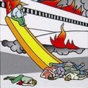
So, uhh, this is kind of  - - https://www.flightglobal.com/news/articles/superjet-accident-probe-studies-heavy-handed-pilot-i-458934/
|
|
#
?
Jun 16, 2019 06:34
|
|

|
hobbesmaster posted:A340 is missing as well. They explicitly call it out as "in production" aircraft so that makes sense. Though that should exclude the beluga technically? Yeah that livery is for the XL. They could have added an A400M though. There was at least one company that was interested in a civilian version.
|
|
#
?
Jun 16, 2019 07:30
|
|
|

|
| # ? May 27, 2024 14:00 |
|
|
Blue Footed Booby posted:Atomic clocks use vibrations. Decay events are random, to the point where you can use slivers of radioisotopes to drive hardware random number generators for e-gambling. Would a quantum computer be able to accurately model the decay, similar to how it can be used to model the outcome of coin flips?
|
|
#
?
Jun 16, 2019 07:40
|
|