


|
SombreroAgnew posted:German Partitions Here's the partition plan Yves Guyot floated for the event of a French total victory in WWI:  It's unlear if it's deliberate or not but it appears to suggest giving the entirety of the Brest-Litovsk area to Poland.
|
 #
¿
Feb 2, 2013 01:46
#
¿
Feb 2, 2013 01:46
|
|


|

|
| # ¿ May 2, 2024 04:11 |
|
|
General Panic posted:I presume it's someone (most likely American) wanting to do for the Middle East what Woodrow Wilson wanted to do for Europe after 1918. If I recall correctly, the premise of the map was "if we had the benefit of hindsight when redrawing the map of the middle east post-WWI and through the era of decolonisation, what would have been the best way to do it?" I somewhat doubt this would indeed be the best way to do it. So, in a similar vein: 
|
|
#
¿
Feb 5, 2013 22:53
|
|
|
twoot posted:Hey everyone remember that Glasgow has a subway too It was one of the first subways ever built though! It was also the first underground cable car, an external powerplant rotated two massive cables running the entire length of the line which the trains would grab to move and release to stop.
|
|
#
¿
Feb 14, 2013 21:17
|
|


|
Strudel Man posted:Do you never mention carbonated sugary drinks outside the context of asking for a specific variety? Anyway, 
|
|
#
¿
Feb 17, 2013 02:55
|
|
|
Uncle Jam posted:There are a hell of a lot of different varieties here, so at someone's house its always pop/soda/whatever because you can't tell what they have. Here is a map of the different varieties (although non carbonated drinks are also included) Eh, there's a load of varieties here too, not the same ones, but every supermarket has an aisle for fizzy drinks (which is the term I'd use if I was saying "I don't let my kids drink soda/pop/coke") an aisle for non-carbonated non-caffeinated soft drinks and an aisle for tea and coffee, but here if you were asking for something at someone else's house you'd ask for "something to drink", and offer exactly the same if you're hosting (or offer "a cup of tea" first, then "something to drink"). As a guest, if my host doesn't have a fizzy drink I like I'd likely prefer tea or water over a fizzy drink I don't like, and as a host I wouldn't offer only fizzy drinks to my guests, in case they want a non-fizzy drink, like water, tea, orange juice or alcohol.   The scale's a little small here but the map shows how isolated some areas of the planet still are and how closely connected the rest of it is.
|
|
#
¿
Feb 17, 2013 19:29
|
|

|
redscare posted:I don't think that restrictions like that count. If they did, all of CA would be yellow because state law prohibits sales between 2am and 8am, as would all other states with similar rules. I'd have thought that map was of each county according to whether the county itself had any restrictions on the sale of alcohol in addition to state laws. So blue is "same laws as the state", yellow is "laws more strict in this county than in the rest of the state" and red is "alcohol sales prohibited in this county". Would there be any counties on the map that definitely would not match up with?
|
|
#
¿
Jun 11, 2013 00:57
|
|
|
I was always quite fond of For Want of a Nail: The British general Burgoyne defeats Gates at the Battle of Saratoga and the British subsequently win the American Revolutionary War. Britain takes a concilliatory attitude and the Confederation of North America is established as a dominion of sorts so the colonies can manage their own affairs as part of the Empire (leading eventually to de facto independence), while the die-hard republicans go into self-imposed exile in Texas and are so successful in their second independence war that they sort of accidentally conquer the country they were declaring independence from, integrating themselves into Mexico's caste system at the top alongside the Criollos. The whole "novel" is written like a history textbook, packed with footnotes for books that were never written, statistical tables of census data, and a foreward by a professor from the United States of Mexico which heavily criticises the text for its "obvious pro-Confederate bias".
|
|
#
¿
Jul 1, 2013 01:29
|
|
|
Hey guys this is a really interesting discussion but if its ok I'm gonna post some maps instead.             Source
|
|
#
¿
Jul 6, 2013 00:11
|
|
|
Crasscrab posted:The phrasing itself is pretty ambiguous. In schools? Yes, I'd say it's almost universal in the United States that smoking is banned within the confines of a school building. On school property? No, most schools (at least college level) have designated smoking areas away from buildings. I don't know if the maps themselves were made by someone British, but since they were posted on the BBC website I expect they're using "school" in the British sense which is education establishments for children, and does not include colleges or universities.
|
|
#
¿
Jul 6, 2013 12:46
|
|
|
computer parts posted:In that case it's pretty disingenuous since legal age for smoking is 18 and most if not all states enforce that. The way I would interpret that map would be "is it illegal for adults (teachers, janitors, admin staff) to smoke in school?" Chances are the map is still wrong though.
|
|
#
¿
Jul 6, 2013 16:41
|
|
|
platedlizard posted:In the US disabled children have the right to go to a public school and be educated, it's a requirement if a school wants federal funding. Sure it's not in the Constitution of the United States, but does it have to be? That map makes no sense at all. I went to the source of the source and this is what they have to say about it: childrenschances.org posted:Why consider constitutions? Which, okay, is fair enough in my opinion, but obviously descends into absurdity when you look at the example of Britain in light of this position and how they portray it on those maps. Our consitution is just "the entire body of enacted legislation taken as a whole" so the distinction they make does not exist in the UK. If the criteria for a constitution are:
|
|
#
¿
Jul 8, 2013 01:57
|
|
|
icantfindaname posted:Yeah it's not a federal system, the national parliament has absolute power legally, it just allows the regional ones to have a bit out of good graces. The regional parliaments didn't exist until the 1970s IIRC, and were basically set up to mollify independence/regional nationalist movements complaining that England had nearly complete control over the political system, which they did. It's even more recent than that, the Scottish parliament and the Welsh and Nothern Irish assemblies date from 1999 (though the Scottish parliament declared itself reconvened after a 300 year adjournment), and in practice the Northern Ireland Assembly didn't really function until 2007.
|
|
#
¿
Jul 12, 2013 00:50
|
|
|
Unreal_One posted:Isn't this one technically incorrect, though? I thought that Great Britain was only the big island, and didn't include the fiddly bits like Mann and the Hebrides and such. Technically yes, though Great Britain is probably the most imprecise term of the lot of them as it very much depends on the context of what is being discussed. Most everyone in Britain will use the other terms in their technically correct sense, but Great Britain could mean the Island, England Scotland and Wales, or the UK depending on what's being discussed. But yeah definitely not the Isle of Man.
|
|
#
¿
Jul 12, 2013 12:31
|
|
|
Lord Hydronium posted:Also notable, the year it was made: 1492. Right before people were about to realize that that big ocean between Europe and Japan shouldn't be empty: This is actually my favourite thing about the whole "Columbus proved the world was round" myth. Part of the reason he had such a hard time getting funding for his trip was not that everyone thought the world was flat, it was that everyone knew the world was round, and more importantly, knew pretty much exactly how large the earth was. Columbus incorrectly believed the world was much smaller than it actually is, which is why he thought it might be possible to reach the Orient by sailing west, and everyone else quite correctly held the view that this would be impossible because you'd have to sail over half the circumference of the Earth in a single trip without stopping to get from the Azores to the Spice Islands. And there was no real reason to just assume there'd be a continent in the middle of that sea. Everyone was perfectly justified in assuming that Columbus' voyage was a suicide mission because his beliefs on the size of the Earth had already been proved wrong millennia before he was even born. And of course, Columbus went to his grave believing that he had reached the Indies and proven that the world was smaller than it actually was. Which must have made all the people saying "you obviously discovered a new continent, dingus" really annoying for him!
|
|
#
¿
Aug 3, 2013 11:44
|
|

|
Shazback posted:The Yellow river is conspicuously absent from this map, despite being the 6th largest river system in the world. I don't know exactly when this map was made, but a possible reason is that the river has changed course several times in recorded history, with courses that ranged from as far north as Beijing to further south than the Shandong peninsula, meaning the author preferred to note the several "possible" paths, but without singling any one out, or even that the map was drawn in a period when the course of the Yellow river was uncertain (war period, period of heavy floods), and as such the author simply couldn't pinpoint where the Yellow river would flow. Another possible reason is that this map was drawn before Emperor Yongle transferred the capital to Beijing, and thus centers on the area around the capital at that time, Nanjing, which is on the Yangtze river (and meant that the far north reach of the empire, where the Yellow river is, might have been less familiar to the author). The yellow river is there, in fact it is one of the most prominent features of the map because it is the only river drawn in yellow. It's just hard to see on the low-res version of the map which has been posted because it is drawn in yellow instead of blue. But if you look closely even at that small version (look at the fold in the centre, then find the yellow line running bottom left to top right across the fold) you can definitely see its course following a general left-to-right (i.e. west-to-east) direction. Your theory is beautiful, but it is not correct I'm afraid.
|
|
#
¿
Aug 3, 2013 12:02
|
|
|
Dr. Tough posted:Have any countries actually formed (and kept) the "greater" versions of themselves? The only one I can think of is the US with manifest destiny. The Kingdom of England spent almost a millenium attempting to enforce its claim of overlordship over the other kingdoms of the british isles, and although in the end the integration of the last holdout (Scotland) was in a sense voluntary, unification of the British Isles under a single state was the culmination of an England's primary foreign policy goal since before England was even a permenant state.
|
|
#
¿
Aug 29, 2013 14:49
|
|
|
Elim Garak posted:But even then you can't say they kept it, since most of Ireland achieved independence. I suppose you could say that, I'd be more inclined to define "kept" as "held for a significant length of time" instead of "still owns the area to this day". In that sense England kept Ireland for several centuries.
|
|
#
¿
Aug 29, 2013 15:21
|
|
|
Squalid posted:
Stereographic, here's a British stereographic projection from 1794:  Here's a link to the absolutely collosal version on Wikimedia: http://en.wikipedia.org/wiki/File:1794_Samuel_Dunn_Wall_Map_of_the_World_in_Hemispheres_-_Geographicus_-_World2-dunn-1794.jpg It also includes a descripion of the projection in the bottom right corner, referring to the projection as the Analemma projection. Reveilled fucked around with this message at 10:55 on Aug 31, 2013 |
|
#
¿
Aug 31, 2013 10:52
|
|


|
Jedi Knight Luigi posted:It looks like Burgenland wasn't a part of the HRE but is a part of modern-day Austria. Wonder how that worked out. The Kingdom of Hungary used to be massive is the basic answer: 
|
|
#
¿
Sep 3, 2013 03:15
|
|
|
Peanut President posted:"Other Responses" are amazing Are ancestry and ethnicity separate questions on the US census? I'm ancestrally Irish (3 of my 4 pairs of great-grandparents were first or second generation Irish immigrants) but since my grandparents on down were born and raised in Scotland I would put Scottish if asked my ethnicity. I figure I'd put Irish if asked my ancestry since I happen to know that but two generations from now I doubt my grandchildren will identify as Irish in any way, and that will be less than two centuries since my Great-grandparents came over. I bring this up because Appalachian doesn't seem particularly absurd to me. Wouldn't that be folks in rural areas some of whom have ancestors who arrived 400 years ago? Is there some other reason it's dumb I don't get?
|
|
#
¿
Sep 3, 2013 18:47
|
|
|
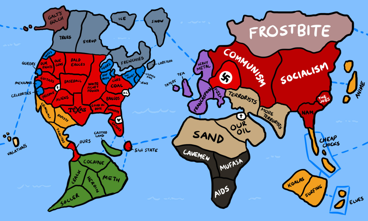
Ammat The Ankh posted:Here's a tongue in cheek map of how Americans view the world, drawn up to look like the game Risk. I'm very curious as to the nationality of the person who drew it, thinking that the average American would know what a Belarus is nevermind identify it as the last dictatorship in Europe.
|
|
#
¿
Sep 8, 2013 02:45
|
|
|
Bro Dad posted:Say what you will about the New World Order, they understand the importance of pretty borders: Jesus gently caress thumbnail that or something Christ. The NWO is pretty uninventive when it comes to names.
|
|
#
¿
Sep 14, 2013 11:51
|
|

|
wikipe tama posted:"Pretty borders" is either a SA contained disease or half of you are cross posters from the Paradox games thread This thread did recently get linked there or in Wiz's LP. I'd be curious to hear thoughts on what ideology the writer of the Manifesto follows. I think these are the key points:
|
|
#
¿
Sep 14, 2013 22:35
|
|
|
I have grown rather fond of Wagner VI as a projection. Looks simple, is simple. Looks good, is good.
|
|
#
¿
Sep 26, 2013 10:37
|
|
|
made of bees posted:Also, Ancient Egypt existed for about 3000 years and was invaded by foreign nations multiple times, so the question of what ethnicity they were is complicated because they probably weren't one thing throughout their existence. There was at least one Nubian dynasty, who I don't think anyone would argue weren't black, and for the last few centuries of its existence, starting with Alexander the Great, the pharaohs were Macedonian. Yeah, the mists of time invite generalisations which are just insane in the context of the massive number of people and years they paint with a single brush. And the monolithic civilisation we refer to as Ancient Egypt is perhaps of all those civilisations the most staggeringly ancient. It's hard to even conceive how broad a time period Ancient Egypt stretched over, but when you consider that the last Pharaoh Cleopatra was born in 69BC but was still born closer to the moon landing than to the building of the Great Pyramid of Giza, you get an inkling of how stupefyingly old Egypt is.
|
|
#
¿
Oct 3, 2013 20:22
|
|
|
Brit here, and I'm as wonky with time as I am with weights and distances. If I am giving an approximation I use the 12 hour clock, but when giving a precise time I use the 24 hour clock (e.g. it's either eighteen fifty six exactly or about five to seven). I set any clock I use to 24 hour mode.
|
|
#
¿
Oct 17, 2013 19:00
|
|
|
Uh, Japan, everyone knows our island is a witch riding a pig, you can't just trample over our heritage like that! 
|
|
#
¿
Oct 20, 2013 17:53
|
|


|
And here's the WWI version:
|
|
#
¿
Oct 23, 2013 01:06
|
|
|
Riso posted:Oh great, a map throwing legitimate democratic parties, like the SVP, together with actual fascists, like Jobbik.  "To create security"
|
|
#
¿
Oct 27, 2013 13:36
|
|
|
steinrokkan posted:They also led the infamous Swiss campaign against mosques and minarets. Still, they are nowhere near the caliber of their supposed Russian or Greek counterparts. The same goes for Poland and UK - wouldn't BNP be a more fitting choice? The BNP are on there, but UKIP are not really any better, they're just the BNP for the middle class*. In any case it's not meant to be a map of fascists in Europe, it's a map showing countries with members of the far-right in their national or the european legislature. From those posters' overt racism the SVP certainly seem far-right, even if they don't literally form mobs that attack minorities. *Another way to put this is that UKIP are the party of "I'm not racist but..." while the BNP are the part of "I am a racist, and..." Reveilled fucked around with this message at 13:59 on Oct 27, 2013 |
|
#
¿
Oct 27, 2013 13:51
|
|
|
GreenCard78 posted:I was talking to a friend who the Midwest yesterday about the different areas of DC and the surrounding burbs. Got an email from him today with this in it: For some reason I feel vaguely bad about the fact that I can look at that map and identify where Rivet City should be.
|
|
#
¿
Nov 1, 2013 01:34
|
|

|
Ofaloaf posted:It was only recently that I realized that regular gas stations here don't even sell 95 octane fuel-- the highest grade is 93 (usually) and commonplace 'regular' gas is 87 octane, which might account a little for the highest gas costs over yonder. Why does Europe demand such high-octane grades, even for everyday commuter cars and the like? No idea, but speaking personally I don't really want to have a think at the pump about which kind of fuel to put in my car. Other than the requirement to either use petrol or diesel, one of the straightforward things about driving here is that regardless of whether I'm driving a city car or a sports car or a 4x4, when I show up at the petrol station I just put the go fast juice in the car and the car works for a little while longer.
|
|
#
¿
Nov 1, 2013 12:59
|
|
|
Ofaloaf posted:What, it's called the same thing but measured differently? Is this a thing like US v. US v. UK gallons? Wikipedia says that the number on American pumps is the "anti knock index", which is an average of two different ways of measuring the octane rating of a fuel, the research octane number and the motor octane number, while european petrol is rated just on the research octane number. So 87 in America is about 92 in Europe, and Unleaded here in the UK which is about 95 would be 91 in America.
|
|
#
¿
Nov 1, 2013 13:22
|
|
|
Phlegmish posted:It's apparently not obvious from the image, but this municipality is absolutely massive in size. If you're out of luck with where you live you have to drive across half the province to get to the town hall. At least, I'm assuming that's how it works in the Netherlands. If they opted for decentralization instead, then you run into the problem mentioned by Mu Cow that they merely added another level of administration whereas the ostensible goal was to simplify matters. It's tiny though. It's 300 square miles with a population 82000. By comparison, here are the Council Areas of Scotland, with Midlothian--roughly equal in size and population to Sudwest Fryslan--highlighted on the map. 
|
|
#
¿
Nov 4, 2013 17:09
|
|
|
ekuNNN posted:That doesn't stop some people, here's The Greatest Netherlands That's got to be a picture from an alternative history. Looking at it I can see New Spain and New France as countries, and various other conglomerated states.
|
|
#
¿
Nov 5, 2013 00:28
|
|


|
Fojar38 posted:So that one was from Harry Turtledove's Southern Victory series right? Nah, Mexico is smaller in that timeline than it is in our own and Mexico still has California on that map. Looks like it's from yet another lovely alt history, Dawn of Hope.
|
|
#
¿
Nov 5, 2013 02:39
|
|
|
Old James posted:I assume these municipalities are administrative regions between province and village. If so, that would be the equivalent of a county in the U.S. Your assumption is incorrect, there's no level below these municipalities. They are perhaps more equivalent to your municipal corporations than your counties (at least in the sense of being the smallest administrative unit. Similar to a county in other ways, probably since no two governments have direct 1:1 equivalents) but in that case it would be the 13th biggest municipal government in the United States by area and much, much larger than any US municipality of equivalent population. And for the sake of comparison of the relative sizes of the lowest level of government, The Highland council in Scotland is the largest council area and is not far off ten times the size of the largest municipality in America, Anchorage Alaska.
|
|
#
¿
Nov 5, 2013 12:48
|
|
|
Gat posted:The lowest level of government in the UK would be civil parishes surely? Of which there are 871 in Scotland. Yeah Scotland's parishes haven't done anything related to local government since the 1920s, our council areas are literally the only thing between citizens and the Scottish Parliament, and up until the establishment of the Scottish Parliament in 1999, it was literally just two tiers of administration, councils and then the UK parliament. England's system just seems like a shitload of redundancy to me.
|
|
#
¿
Nov 5, 2013 20:54
|
|

|
Vivian Darkbloom posted:
Missingno is real?
|
|
#
¿
Nov 8, 2013 04:37
|
|

|

|
| # ¿ May 2, 2024 04:11 |
|
|
Vivian Darkbloom posted:
It looks like it's a recreation of a map from the book Lands of the Eastern Caliphate, a history book from the early 20th century about the Abbasid caliphate. Each area on the inset map has a chapter devoted to how the caliphate affected the history of the area.
|
|
#
¿
Nov 9, 2013 01:38
|
|
